G'day, y'all!!!
This morning, while surfing the British SABRE site, I found a link to an Australian road blog called SEQRoads (SEQ stands for Southeast Queensland, the state located in Australia's northeastern corner.) Please click here to see for yourself.
Now this is not the first time I've ever seen road photos from "down under", but I am truly fascinated how the Australians have taken a combination of European and North American road sign and design styles and amalgamated them into something that is uniquely their own. To see a prime example of Brisbane's roads, here's a link to a photo site maintained by SEQRoads blogmaster Trent.
As for the Aussies themselves, the vast majority my wife and I have ever met (primarily through Toastmasters) are some of the nicest, warmest folks you will ever encounter anywhere in the world. At some point in our lives, we would love to visit Australia... and when we do, you bet we're gonna "roadgeek" it up. Furthermore, it is my personal dream to drive on Australia's roads just to get the feeling of left-hand side driving. :)
Kudos to their blogmaster on an excellent blog and wonderful road pics from "down under".
Thanks to y'all for reading ours. Take care and have a great weekend.
P.S. If you are from Australia and would like a free official "Georgia Road Geek" magnet, then please e-mail your postal address to georgiaroadgeek at bellsouth dot net.
Saturday, March 11, 2006

Friday, March 10, 2006
Video Gallery Now Available
Dear Readers,
Thanks to the good folks at Putfile, we here at "The Georgia Road Geek" offer to you a media gallery of assorted homemade "roadgeek videos" for your viewing pleasure.
We run the gamut of the fairly serious to the really wacky.
Our first set includes the Talmadge Bridge videos, plus some GA 400 construction videos taken on March 7, 2006. Please click here to access them.
If you like it (or even if you don't like it), then please let us know by e-mailing georgiaroadgeek at bellsouth dot net. NOTE: If you don't like it, then please be gentle with us. :)
Thanks for visiting and please come back again.
Thanks to the good folks at Putfile, we here at "The Georgia Road Geek" offer to you a media gallery of assorted homemade "roadgeek videos" for your viewing pleasure.
We run the gamut of the fairly serious to the really wacky.
Our first set includes the Talmadge Bridge videos, plus some GA 400 construction videos taken on March 7, 2006. Please click here to access them.
If you like it (or even if you don't like it), then please let us know by e-mailing georgiaroadgeek at bellsouth dot net. NOTE: If you don't like it, then please be gentle with us. :)
Thanks for visiting and please come back again.
I-75: A Superhighway On Steroids
A superhighway on steriods.... SAY WHAAAAAT?!!!!
If the Georgia DOT and the Georgia Transportation Partners consortium have their way, I-75 in Cobb County, at a whopping 23 lanes wide, will truly be a superhighway on steroids!!!
Furthermore, under the Northwest Corridor public-private initiative proposal, I-75 and I-575 would be "guinea pigs" for a little-tested concept of truck-only toll lanes, which, according to the Atlanta-Journal Constitution, the Georgia Motor Trucking Association is apparently wary of.
To read more about it, please click here for the article from the Atlanta-Journal Constitution.
Is this going to help us here in Metro Atlanta solve our traffic problems? I don't know... but I do know that our elected officials need to help us get a handle on the out-of-control growth that has exacerbated the entire traffic situation.
Am I "anti-roads"? No. Am I "pro-controlled development"? You betcha.
What can we do to get a handle on this out-of-control development? I don't have all the answers, but I do know that we need to let our elected officials know that they need to stop letting developers run amok and put some kind of reasonable controls on such things as new subdivisions and shopping malls. By doing so, it can help to guarantee the quality of life for both us and future generations, plus help Metro Atlanta remain a place where businesses want to set up shop. Again, I don't have all the answers, but we and our elected officials need to start somewhere.
That's all for now. Thanks for visiting and please come back again.
If the Georgia DOT and the Georgia Transportation Partners consortium have their way, I-75 in Cobb County, at a whopping 23 lanes wide, will truly be a superhighway on steroids!!!
Furthermore, under the Northwest Corridor public-private initiative proposal, I-75 and I-575 would be "guinea pigs" for a little-tested concept of truck-only toll lanes, which, according to the Atlanta-Journal Constitution, the Georgia Motor Trucking Association is apparently wary of.
To read more about it, please click here for the article from the Atlanta-Journal Constitution.
Is this going to help us here in Metro Atlanta solve our traffic problems? I don't know... but I do know that our elected officials need to help us get a handle on the out-of-control growth that has exacerbated the entire traffic situation.
Am I "anti-roads"? No. Am I "pro-controlled development"? You betcha.
What can we do to get a handle on this out-of-control development? I don't have all the answers, but I do know that we need to let our elected officials know that they need to stop letting developers run amok and put some kind of reasonable controls on such things as new subdivisions and shopping malls. By doing so, it can help to guarantee the quality of life for both us and future generations, plus help Metro Atlanta remain a place where businesses want to set up shop. Again, I don't have all the answers, but we and our elected officials need to start somewhere.
That's all for now. Thanks for visiting and please come back again.
Wednesday, March 08, 2006
A Salute To Britain's Roadgeeks
Tonight, thanks to fellow road enthusiast Graham in London, I've discovered that there's a whole mess of roadgeeks in the United Kingdom.
We here at "The Georgia Road Geek" salute them from "across the pond" and present to you, dear reader, a link to SABRE (the Society for All British Road Enthusiasts). It's a great road site with some really cool UK road pics.
Please click here to see for yourself.
British roadgeeks, if you're visiting this blogsite, then please send us an e-mail (georgiaroadgeek at bellsouth dot net) and let us know you've visited. If you provide us with your postal address, we'll even send you an official "Georgia Road Geek" magnet as a token of our friendship and appreciation.
Whether you are from London, England, or London, Kentucky... Rome, Italy, or Rome, Georgia... we appreciate your visit and hope you will do so often.
Kudos to all our British SABRE roadgeek cousins for their excellence in "roadgeeking".
Until next time, cheerio from Georgia, y'all!!! :)
We here at "The Georgia Road Geek" salute them from "across the pond" and present to you, dear reader, a link to SABRE (the Society for All British Road Enthusiasts). It's a great road site with some really cool UK road pics.
Please click here to see for yourself.
British roadgeeks, if you're visiting this blogsite, then please send us an e-mail (georgiaroadgeek at bellsouth dot net) and let us know you've visited. If you provide us with your postal address, we'll even send you an official "Georgia Road Geek" magnet as a token of our friendship and appreciation.
Whether you are from London, England, or London, Kentucky... Rome, Italy, or Rome, Georgia... we appreciate your visit and hope you will do so often.
Kudos to all our British SABRE roadgeek cousins for their excellence in "roadgeeking".
Until next time, cheerio from Georgia, y'all!!! :)
Monday, March 06, 2006
Talmadge Bridge Videos - 10/29/2005
Hot off the DVD from CVS, here are the videos of our roadgeek travels across the Talmadge Memorial Bridge in Savannah (video taken October 29, 2005, with a cheapo CVS handheld camcorder)...
- Going toward South Carolina
- Heading back to Georgia
A special thanks to my wife Mary for her assistance in filming while I was driving. :)
I hope to get some videos of the GA 400 construction. Once I do so, I'll share them with y'all ASAP.
Hope y'all enjoy, thanks for visiting, and please do so often.
- Going toward South Carolina
- Heading back to Georgia
A special thanks to my wife Mary for her assistance in filming while I was driving. :)
I hope to get some videos of the GA 400 construction. Once I do so, I'll share them with y'all ASAP.
Hope y'all enjoy, thanks for visiting, and please do so often.
DVDs, CBs, Movies, and GA 400
This afternoon, my Smokey and the Bandit DVDs arrived from Amazon.com. To celebrate this new arrival at "The Georgia Road Geek" world headquarters, here's a website with some "CB speak" for y'all.
For my wife, I got Disney's "Lady and the Tramp" (50th Anniversary Edition), and I think I scored some points with "The Mrs." on that one. :)
Also, I've used up the last 3 minutes of my CVS digital recorder, so tonight, I'll take it by my local CVS to get it developed.
The DVD has our trips back and forth across Savannah's Talmadge Memorial Bridge, plus some assorted home movies of our "four-legged children" (cats).
Today on GA 400, the construction crews have finally started grading out part of the median in the Holcomb Bridge Road vicinity after adding drainage pipes. Also, it looks like some new BGSes are going up in the vicinity of GA 120/Old Milton Parkway (Exit 10).
Hope y'all had a great weekend and thanks for stopping by again.
Until next time, keep 'er between the ditches, keep "Smokey" out of your britches, and we'll catch you on the "flip-flop".
For my wife, I got Disney's "Lady and the Tramp" (50th Anniversary Edition), and I think I scored some points with "The Mrs." on that one. :)
Also, I've used up the last 3 minutes of my CVS digital recorder, so tonight, I'll take it by my local CVS to get it developed.
The DVD has our trips back and forth across Savannah's Talmadge Memorial Bridge, plus some assorted home movies of our "four-legged children" (cats).
Today on GA 400, the construction crews have finally started grading out part of the median in the Holcomb Bridge Road vicinity after adding drainage pipes. Also, it looks like some new BGSes are going up in the vicinity of GA 120/Old Milton Parkway (Exit 10).
Hope y'all had a great weekend and thanks for stopping by again.
Until next time, keep 'er between the ditches, keep "Smokey" out of your britches, and we'll catch you on the "flip-flop".
Sunday, March 05, 2006
GA City Makes Wacky Street Name List
This weekend, my wife found an article in USA Today about a recent online poll of America's "wildest, wackiest, and weirdest street names" and suggested that I blog about it.
Sponsored by Mitsubishi Motors, The Car Connection website conducted this poll.
Albany, GA, made the top 10 list with its intersection of Lonesome and Hardup Roads.
For the full article from USA Today, please click here.
A special thanks to my lovely wife for sharing this wonderful article with me and I hope y'all enjoy it as much as I did.
Thanks for visiting and please come back again.
Sponsored by Mitsubishi Motors, The Car Connection website conducted this poll.
Albany, GA, made the top 10 list with its intersection of Lonesome and Hardup Roads.
For the full article from USA Today, please click here.
A special thanks to my lovely wife for sharing this wonderful article with me and I hope y'all enjoy it as much as I did.
Thanks for visiting and please come back again.
Friday, March 03, 2006
You Can Drive 55
Over 20 years ago, singer Sammy Hagar released a highly controverisal (but really "kick-butt") song called "I Can't Drive 55". The video to this song was a pretty big hit on MTV (back when they were truly Music Television).
Well... according to four (4) Georgia college students, you can... and in an act of self-proclaimed "civil obedience", they got in their respective vehicles and together, they actually did literally drive 55 MPH on I-285.
But wait, folks, there's more... they even filmed themselves doing so and won a film award for their efforts. Please click here for their movie "A Meditation On The Speed Limit".
Naturally, they made several folks really angry and frustrated while doing so, but hey, like the late Andy Warhol said, they got their proverbial "15 minutes of fame".
Please click here to read the article from the Atlanta Journal-Constitution.
Yes, Virginia. You can drive 55 on I-285. :)
Thanks for visiting and have a great weekend!!!
Well... according to four (4) Georgia college students, you can... and in an act of self-proclaimed "civil obedience", they got in their respective vehicles and together, they actually did literally drive 55 MPH on I-285.
But wait, folks, there's more... they even filmed themselves doing so and won a film award for their efforts. Please click here for their movie "A Meditation On The Speed Limit".
Naturally, they made several folks really angry and frustrated while doing so, but hey, like the late Andy Warhol said, they got their proverbial "15 minutes of fame".
Please click here to read the article from the Atlanta Journal-Constitution.
Yes, Virginia. You can drive 55 on I-285. :)
Thanks for visiting and have a great weekend!!!
Thursday, March 02, 2006
GA 400 Was A Movie Star
Last night as I pulled into the driveway, I was listening to one of Atlanta’s country stations.
They were playing the Jerry Reed song “East Bound And Down”, the theme to the 1977 Burt Reynolds movie “Smokey And The Bandit” (SATB), and it brought back memories of my childhood in Snellville.
The first time I saw the movie was at the old Snellville Cinema. I enjoyed the movie so much, I went back there to see it at least 1 or 2 more times. In fact, I give SATB credit for shaping my very early roadgeek existence. :)
For those of you who may not have seen the movie, here’s the premise…
An eccentric father/son pair of Texas millionaires named “Big Enos” and “Little Enos” make an outrageous big-money deal with an egotistical thrillseeker, “The Bandit” (Burt Reynolds), to pick up a tractor-trailer load of Coors Beer in Texarkana, Texas, and bring it back to Atlanta in an 18-hour round trip. (At the time, Coors Beer was not allowed in Georgia, thus it was roughly an equivalent to running moonshine.)
“The Bandit” talks his reluctant trucker friend Cletus “Snowman” Snow (Jerry Reed) into accompanying him in this insane quest. “Snowman” drives the tractor-trailer full of beer while “Bandit” runs interference miles ahead of him with his Pontiac Trans Am. Their primary means of communcation were their CB radios.
On the way back, “Bandit” unwittingly picks up a runaway bride, Carrie (Sally Field), who was to be married to the dimwitted son of Texarkana Sheriff Buford T. Justice (Jackie Gleason).
When the Sheriff learns that Carrie is with “The Bandit”, he and his dimwitted son “Junior” go on a cross-country pursuit of “The Bandit”.
The result was one of the craziest, wackiest cross-country car chases in movie history, plus a real-life surge in the sales of CB radios and Pontiac Trans-Ams.
I remember the fun we had traveling down to Florida with the new 23-channel Cobra CB rig my dad bought and installed in the family car (which was not a Trans-Am, but a 1972 Grand Prix which I would later have as my car during my college years). As a kid, it was pretty cool "spotting Smokies" (police) and "ratchet-jawing" (speaking) with other CBers. Eventually, as CBs became passe along with other 1970s fads like disco (I HATE DISCO!!!), I grew out of it.
The movie was filmed in various locations around metro Atlanta, including freeway scenes that were shot on the stretch of GA 400 between Alpharetta and Cumming. At the time SATB was filmed(1976-1977), GA 400 made a great filming location since it was sparsely used… quite a contrast to the huge traffic volumes it has due to the phenomenal growth of North Fulton and Forsyth Counties in the 1990s.
One particular scene was where a Georgia State Patrol car was chasing “The Bandit’s” Trans-Am around and around an interchange. The interchange was GA 141 (Exit 13).
This afternoon, I just ordered SATB from Amazon.com. This also includes the totally lame sequels SATB II and SATB III, but it was the only way I could get the first SATB :(
That's all for now. Thanks for your visit, keep 'er between the ditches, and we'll catch you on the "flip-flop", good buddy!!! :)
They were playing the Jerry Reed song “East Bound And Down”, the theme to the 1977 Burt Reynolds movie “Smokey And The Bandit” (SATB), and it brought back memories of my childhood in Snellville.
The first time I saw the movie was at the old Snellville Cinema. I enjoyed the movie so much, I went back there to see it at least 1 or 2 more times. In fact, I give SATB credit for shaping my very early roadgeek existence. :)
For those of you who may not have seen the movie, here’s the premise…
An eccentric father/son pair of Texas millionaires named “Big Enos” and “Little Enos” make an outrageous big-money deal with an egotistical thrillseeker, “The Bandit” (Burt Reynolds), to pick up a tractor-trailer load of Coors Beer in Texarkana, Texas, and bring it back to Atlanta in an 18-hour round trip. (At the time, Coors Beer was not allowed in Georgia, thus it was roughly an equivalent to running moonshine.)
“The Bandit” talks his reluctant trucker friend Cletus “Snowman” Snow (Jerry Reed) into accompanying him in this insane quest. “Snowman” drives the tractor-trailer full of beer while “Bandit” runs interference miles ahead of him with his Pontiac Trans Am. Their primary means of communcation were their CB radios.
On the way back, “Bandit” unwittingly picks up a runaway bride, Carrie (Sally Field), who was to be married to the dimwitted son of Texarkana Sheriff Buford T. Justice (Jackie Gleason).
When the Sheriff learns that Carrie is with “The Bandit”, he and his dimwitted son “Junior” go on a cross-country pursuit of “The Bandit”.
The result was one of the craziest, wackiest cross-country car chases in movie history, plus a real-life surge in the sales of CB radios and Pontiac Trans-Ams.
I remember the fun we had traveling down to Florida with the new 23-channel Cobra CB rig my dad bought and installed in the family car (which was not a Trans-Am, but a 1972 Grand Prix which I would later have as my car during my college years). As a kid, it was pretty cool "spotting Smokies" (police) and "ratchet-jawing" (speaking) with other CBers. Eventually, as CBs became passe along with other 1970s fads like disco (I HATE DISCO!!!), I grew out of it.
The movie was filmed in various locations around metro Atlanta, including freeway scenes that were shot on the stretch of GA 400 between Alpharetta and Cumming. At the time SATB was filmed(1976-1977), GA 400 made a great filming location since it was sparsely used… quite a contrast to the huge traffic volumes it has due to the phenomenal growth of North Fulton and Forsyth Counties in the 1990s.
One particular scene was where a Georgia State Patrol car was chasing “The Bandit’s” Trans-Am around and around an interchange. The interchange was GA 141 (Exit 13).
This afternoon, I just ordered SATB from Amazon.com. This also includes the totally lame sequels SATB II and SATB III, but it was the only way I could get the first SATB :(
That's all for now. Thanks for your visit, keep 'er between the ditches, and we'll catch you on the "flip-flop", good buddy!!! :)
Wednesday, February 22, 2006
GA 400 News - 2/22/2006
GA 400 Northbound Construction Pics - 2/21/2006
I have just created a webpage featuring six (6) GA 400 northbound construction photos. To see them, please click here.
Lawmakers Target GA 400 Toll Runners
Georgia's State Road and Tollway Authority (SRTA) reports that there are over $900,000 in uncollected GA 400 tolls due to a high number of "toll runners".
As a result, a bill has been introduced in the Georgia House of Representatives (HB 1190) to close loopholes that SRTA says allows too many drivers to get away with not paying the $0.50 toll. For the article from WSB-TV, please click here.
For a video from WSB-TV on the GA 400 "toll runner" bill, please click here.
There's even audio of alleged "toll runner" Dennis K. Larson being interviewed by WSB-AM 750 talk show host Neal Boortz. This interview is very interesting and I highly encourage you to listen to it.
Please note that while we here at "The Georgia Road Geek" find the interview very interesting, we absolutely do not encourage anyone to break the law regarding the GA 400 tolls or any other law that is on the books. If you disagree with the GA 400 tolls or any other state laws, then please do like Mr. Boortz did and write your state legislators accordingly.
GA 400 Ramp Meters
Finally, we have asked for someone at the Georgia DOT to give us information regarding the new ramp meters installed from Sandy Springs to Alpharetta. Once we find something out, we'll let you know.
That's all for now. Thanks for visiting and please do so often.
I have just created a webpage featuring six (6) GA 400 northbound construction photos. To see them, please click here.
Lawmakers Target GA 400 Toll Runners
Georgia's State Road and Tollway Authority (SRTA) reports that there are over $900,000 in uncollected GA 400 tolls due to a high number of "toll runners".
As a result, a bill has been introduced in the Georgia House of Representatives (HB 1190) to close loopholes that SRTA says allows too many drivers to get away with not paying the $0.50 toll. For the article from WSB-TV, please click here.
For a video from WSB-TV on the GA 400 "toll runner" bill, please click here.
There's even audio of alleged "toll runner" Dennis K. Larson being interviewed by WSB-AM 750 talk show host Neal Boortz. This interview is very interesting and I highly encourage you to listen to it.
Please note that while we here at "The Georgia Road Geek" find the interview very interesting, we absolutely do not encourage anyone to break the law regarding the GA 400 tolls or any other law that is on the books. If you disagree with the GA 400 tolls or any other state laws, then please do like Mr. Boortz did and write your state legislators accordingly.
GA 400 Ramp Meters
Finally, we have asked for someone at the Georgia DOT to give us information regarding the new ramp meters installed from Sandy Springs to Alpharetta. Once we find something out, we'll let you know.
That's all for now. Thanks for visiting and please do so often.
Tuesday, February 21, 2006
Georgia's "Steer It/Clear It" Law
Dear Reader,
Thanks to "Georgia Road Geek" reader Steve Anderson, we now bring you Georgia's "steer it/clear it" law for your reading pleasure. It is Georgia Code 40-6-275 (c), which reads as follows...
When a motor vehicle traffic accident occurs with no apparent serious personal injury or death, it shall be the duty of the drivers of the motor vehicles involved in such traffic accident, or any other occupant of any such motor vehicle who possesses a valid driveŕs license, to remove said vehicles from the immediate confines of the roadway into a safe refuge on the shoulder, emergency lane, or median or to a place otherwise removed from the roadway whenever such moving of a vehicle can be done safely and the vehicle is capable of being normally and safely driven, does not require towing, and can be operated under its own power in its customary manner without further damage or hazard to itself, to the traffic elements, or to the roadway. The driver of any such motor vehicle may request any person who possesses a valid driveŕs license to remove any such motor vehicle as provided in this Code section, and any such person so requested shall be authorized to comply with such request.
For this particular Georgia Code section in its entirety, please click here.
Incidentally, the slogan "If You Can Steer It, Clear It" was used by the State of Georgia to help make motorists aware of this particular law if and when they are involved in a traffic accident on Georgia's roads. I wish I still had a copy of the pamphlet they pubished years ago. :(
PLEASE NOTE: "The Georgia Road Geek" does not intend for this blog, or any other blogs referencing state, federal, or local laws, to be construed as legal advice, nor does "The Georgia Road Geek" offer any explicit or implicit legal advice to any of its readers. It is solely the reader's responsibility to consult a lawyer for expert advice and counsel regarding any law.
BTW, please look for more GA 400 construction photos in future blogs.
That's all for now. Thanks again to Steve Anderson for sharing his research with us, thank you for your visit, and please come back often.
Thanks to "Georgia Road Geek" reader Steve Anderson, we now bring you Georgia's "steer it/clear it" law for your reading pleasure. It is Georgia Code 40-6-275 (c), which reads as follows...
When a motor vehicle traffic accident occurs with no apparent serious personal injury or death, it shall be the duty of the drivers of the motor vehicles involved in such traffic accident, or any other occupant of any such motor vehicle who possesses a valid driveŕs license, to remove said vehicles from the immediate confines of the roadway into a safe refuge on the shoulder, emergency lane, or median or to a place otherwise removed from the roadway whenever such moving of a vehicle can be done safely and the vehicle is capable of being normally and safely driven, does not require towing, and can be operated under its own power in its customary manner without further damage or hazard to itself, to the traffic elements, or to the roadway. The driver of any such motor vehicle may request any person who possesses a valid driveŕs license to remove any such motor vehicle as provided in this Code section, and any such person so requested shall be authorized to comply with such request.
For this particular Georgia Code section in its entirety, please click here.
Incidentally, the slogan "If You Can Steer It, Clear It" was used by the State of Georgia to help make motorists aware of this particular law if and when they are involved in a traffic accident on Georgia's roads. I wish I still had a copy of the pamphlet they pubished years ago. :(
PLEASE NOTE: "The Georgia Road Geek" does not intend for this blog, or any other blogs referencing state, federal, or local laws, to be construed as legal advice, nor does "The Georgia Road Geek" offer any explicit or implicit legal advice to any of its readers. It is solely the reader's responsibility to consult a lawyer for expert advice and counsel regarding any law.
BTW, please look for more GA 400 construction photos in future blogs.
That's all for now. Thanks again to Steve Anderson for sharing his research with us, thank you for your visit, and please come back often.
Monday, February 20, 2006
GA 316 Official Groundbreaking
Fellow road enthusiasts, here's the latest on the GA 316 front...
Today, Governor Sonny Perdue has officially broken ground for the I-85/GA 316 interchange improvements. Please click here for the story from the WSB-TV website.
Earlier today, the Atlanta-Journal Constitution had an article about the impact of the 316 construction on local businesses around the interchange itself. One local businessman in that vicinity attributes it to a "shot in the gut". Please click here for the article.
According to a WSB-TV news article just broadcast before composing this blog, one of the new ramps will allow traffic to go straight from GA 316 westbound to Pleasant Hill Road without ever having to be on I-85.
As more developments occur, we here at "The Georgia Road Geek" will keep you abreast.
That's all for now. Thanks for reading and please come back often.
Today, Governor Sonny Perdue has officially broken ground for the I-85/GA 316 interchange improvements. Please click here for the story from the WSB-TV website.
Earlier today, the Atlanta-Journal Constitution had an article about the impact of the 316 construction on local businesses around the interchange itself. One local businessman in that vicinity attributes it to a "shot in the gut". Please click here for the article.
According to a WSB-TV news article just broadcast before composing this blog, one of the new ramps will allow traffic to go straight from GA 316 westbound to Pleasant Hill Road without ever having to be on I-85.
As more developments occur, we here at "The Georgia Road Geek" will keep you abreast.
That's all for now. Thanks for reading and please come back often.
Friday, February 17, 2006
Georgia Road Geek News - 2/17/2006
GDOT Official Interstate Celebration Website Online
As of today, the Georgia DOT has launched its own website to celebrate the Interstate's 50th Birthday at www.dot.state.ga.us/50th.
Included on the website are some vintage 195o's and 1960's GDOT maps, plus interviews on such topics as why I-85 got routed between Gainesville and Athens.
The official history of Georgia's Interstates can be found in the PDF document "Georgia Celebrates the Interstates". Between this document and history info J.T. Legg has shared, this has been a wonderful learning experience for me. :)
If you are a "road scholar" like me, or at least a little curious, then I encourage you to visit their new website and see it all for yourself.
Proposed New Interchanges/HOV Lanes For GA 316
According to a GDOT press release dated February 1st, there is a proposal to build HOV lanes on GA 316 and upgrade its intersections with Collins Hill Road and GA 20/124 to interchanges. Please click here for the full press release document.
If You Can Steer It... CLEAR IT!!!
This afternoon, on GA 9, just north of Milton Avenue in Downtown Alpharetta, there was a 3-car "fender-bender" in front of the Louie Jones Funeral Home.
For at least 5 minutes, the individuals just sat there and held up traffic, which even on a good weekday afternoon can stink. None of the vehicles involved was disabled, thus they could be easily driven off the highway and into the funeral home parking lot. Finally, they did.
What's my point, dear reader? Simple... if you can steer it, clear it!!!
As of today, the Georgia DOT has launched its own website to celebrate the Interstate's 50th Birthday at www.dot.state.ga.us/50th.
Included on the website are some vintage 195o's and 1960's GDOT maps, plus interviews on such topics as why I-85 got routed between Gainesville and Athens.
The official history of Georgia's Interstates can be found in the PDF document "Georgia Celebrates the Interstates". Between this document and history info J.T. Legg has shared, this has been a wonderful learning experience for me. :)
If you are a "road scholar" like me, or at least a little curious, then I encourage you to visit their new website and see it all for yourself.
Proposed New Interchanges/HOV Lanes For GA 316
According to a GDOT press release dated February 1st, there is a proposal to build HOV lanes on GA 316 and upgrade its intersections with Collins Hill Road and GA 20/124 to interchanges. Please click here for the full press release document.
If You Can Steer It... CLEAR IT!!!
This afternoon, on GA 9, just north of Milton Avenue in Downtown Alpharetta, there was a 3-car "fender-bender" in front of the Louie Jones Funeral Home.
For at least 5 minutes, the individuals just sat there and held up traffic, which even on a good weekday afternoon can stink. None of the vehicles involved was disabled, thus they could be easily driven off the highway and into the funeral home parking lot. Finally, they did.
What's my point, dear reader? Simple... if you can steer it, clear it!!!
Unless the vehicle in question has been disabled or there is an injured person inside of it, Georgia law requires that the vehicle(s) be moved to the side of the road so as not to impede the normal flow of traffic. If I find the specific Georgia Code section, then I'll let you know, but if you know (please give exact Georgia Code number), then please e-mail it to me at georgiaroadgeek at bellsouth dot net.
Get Your "Georgia Road Geek" Fix (RSS Or E-Mail)
Finally, you can get your "feeds" of this blog via not only Atom, but also via other Really Simple Subscription (RSS) browsers and even e-mail. Please see "Table of Contents" for the links.
My wife and I are hungry and it's time for dinner. Thanks always for visiting and have a great weekend!
Wednesday, February 15, 2006
A Half-Century of Interstates
On June 29, 1956, President Dwight D. Eisenhower signed the Federal-Aid Highway Act of 1956, which launched the largest roadbuilding program in American history... construction of the Interstate Highway System!!!
Last November, I blogged about Georgia's connection to its glorious history. Please click here to read.
And now, for your reading pleasure, a little history...
Georgia's original interstates were I-16, I-20, I-24, I-59, I-75, I-85, I-95, I-185, I-285, and I-475. These original Georgia interstates were completed in 1979, I-185 being the very last to be completed. From what I remember seeing on one of my dad's old roadmaps from circa 1960, the first stretch of Georgia Interstate to be opened was a portion of I-75 in south Georgia.
Since these original Interstates, Georgia has added even more Interstates as follows:
- I-516 (GA 21 until circa 1990.)
- I-520 (GA 232 until circa 1977.)
- I-575 (Construction began in 1978, completed by 1990.)
- I-675 (Opened in 1988.)
- I-985 (The limited-access portion of GA 365 that was designated with this route number in 1985.)
Interstates 420 (Lakewood Freeway extension from I-75/85 to I-20) and 485 (Stone Mountain Tollway) were proposed for the City of Atlanta, but were ultimately squashed by neighborhood groups. Part of the proposed I-485 route eventually became Freedom Parkway, with the Carter Library being in the middle of what would have been an interchange between it and a proposed GA 400 extension to the southside.
There was also a proposed I-175 that would have run from I-75 in Cordele to Albany, but, alas, Albany would not have its Interstate. Instead, I-175 was scrapped in favor of the "watered-down" Georgia-Florida Parkway (GA 300), whose interchange at I-75 (Exit 99) is where I-175 would have met I-75.
In recent years, Congress has proposed 2 more Interstates for Georgia as follows:
- I-3 (Savannah to Knoxville, via Augusta and the northeast Georgia mountains.)
- I-14 (Alexandria, LA, to Augusta, via Columbus and Macon/Warner Robins.)
Although politicians are promoting the perceived economic benefits of I-3, it is heavily and vehemently opposed by residents of the northeast Georgia mountains, western North Carolina, and eastern Tennessee. See the "STOP I-3" website for details.
I-14 has also been proposed for economic development purposes, but I do not know of any organized oppostion group for this proposal. In any event, it could be years before the first spadeful of dirt is broken for either highway (assuming the Georgia DOT does anything to get these projects on the drawing board in the first place).
I still remember when I-20 dead-ended at GA 5 in Douglas County. At that time, you had to take US 78 into Alabama, where you'd pick up I-20 again via AL 9. When we traveled that particular stretch of I-20 to and from Birmingham last June, I still had a picture in my mind of how it looked when I was a little boy traveling with family to see my maternal relatives in Douglasville. Yes, dear reader, I was destined to be a full-fledged, unrepentant roadgeek... and I'm darn proud of it, y'all!!! :)
Now that I've given you a short history lesson (plus a brief detour down "Memory Lane"), I encourage each of you to mark June 29, 2006, on your calendar and wish the Dwight David Eisenhower Interstate System a happy 50th birthday.
For more information about the Interstate's 50th birthday (including a lot of great history), please visit the official celebration website at the American Association of State Highway and Transporation Officials (AASHTO), www.interstate50th.org.
Thanks for visiting and please come again.
Last November, I blogged about Georgia's connection to its glorious history. Please click here to read.
And now, for your reading pleasure, a little history...
Georgia's original interstates were I-16, I-20, I-24, I-59, I-75, I-85, I-95, I-185, I-285, and I-475. These original Georgia interstates were completed in 1979, I-185 being the very last to be completed. From what I remember seeing on one of my dad's old roadmaps from circa 1960, the first stretch of Georgia Interstate to be opened was a portion of I-75 in south Georgia.
Since these original Interstates, Georgia has added even more Interstates as follows:
- I-516 (GA 21 until circa 1990.)
- I-520 (GA 232 until circa 1977.)
- I-575 (Construction began in 1978, completed by 1990.)
- I-675 (Opened in 1988.)
- I-985 (The limited-access portion of GA 365 that was designated with this route number in 1985.)
Interstates 420 (Lakewood Freeway extension from I-75/85 to I-20) and 485 (Stone Mountain Tollway) were proposed for the City of Atlanta, but were ultimately squashed by neighborhood groups. Part of the proposed I-485 route eventually became Freedom Parkway, with the Carter Library being in the middle of what would have been an interchange between it and a proposed GA 400 extension to the southside.
There was also a proposed I-175 that would have run from I-75 in Cordele to Albany, but, alas, Albany would not have its Interstate. Instead, I-175 was scrapped in favor of the "watered-down" Georgia-Florida Parkway (GA 300), whose interchange at I-75 (Exit 99) is where I-175 would have met I-75.
In recent years, Congress has proposed 2 more Interstates for Georgia as follows:
- I-3 (Savannah to Knoxville, via Augusta and the northeast Georgia mountains.)
- I-14 (Alexandria, LA, to Augusta, via Columbus and Macon/Warner Robins.)
Although politicians are promoting the perceived economic benefits of I-3, it is heavily and vehemently opposed by residents of the northeast Georgia mountains, western North Carolina, and eastern Tennessee. See the "STOP I-3" website for details.
I-14 has also been proposed for economic development purposes, but I do not know of any organized oppostion group for this proposal. In any event, it could be years before the first spadeful of dirt is broken for either highway (assuming the Georgia DOT does anything to get these projects on the drawing board in the first place).
I still remember when I-20 dead-ended at GA 5 in Douglas County. At that time, you had to take US 78 into Alabama, where you'd pick up I-20 again via AL 9. When we traveled that particular stretch of I-20 to and from Birmingham last June, I still had a picture in my mind of how it looked when I was a little boy traveling with family to see my maternal relatives in Douglasville. Yes, dear reader, I was destined to be a full-fledged, unrepentant roadgeek... and I'm darn proud of it, y'all!!! :)
Now that I've given you a short history lesson (plus a brief detour down "Memory Lane"), I encourage each of you to mark June 29, 2006, on your calendar and wish the Dwight David Eisenhower Interstate System a happy 50th birthday.
For more information about the Interstate's 50th birthday (including a lot of great history), please visit the official celebration website at the American Association of State Highway and Transporation Officials (AASHTO), www.interstate50th.org.
Thanks for visiting and please come again.
Tuesday, February 14, 2006
DUI Victims Memorial Signs
On newsgroup misc.transport.road, I found an article about Georgia's first DUI victims memorial sign that was erected on I-16 near Statesboro. Please click here for the news article from Access North Georgia.
The DUI memorial sign program is run by Georgia's Criminal Justice Coordinating Council (CJCC) in cooperation with the Georgia DOT (GDOT).
If you had a loved-one who was killed by a drunk driver on any Georgia state-maintained highway and the individual who committed the DUI was convicted, then the victim's family may qualify to have a sign erected in their loved-one's memory. The CJCC pays GDOT for the sign with money from the state's crime victims compensation fund. For further details and an application, please click here to access their website.
I hope and pray that you never have to consider taking advantage of such a program, but IMHO, it's not a bad idea for reminding drivers of the tragic consquences of DUI on families. Even with much greater awareness of the dangers of drinking and driving, one DUI and one victim is still one too many.
If you drink, then please don't drive... and if you have to drive, then please don't drink before you do. Staying sober behind the wheel will keep you from potentially ruining both your life and the lives of countless others.
My wife just got home and now it's time to celebrate Valentines Day. Thanks always for visiting and may you and yours have a happy and safe Valentines Day. :)
The DUI memorial sign program is run by Georgia's Criminal Justice Coordinating Council (CJCC) in cooperation with the Georgia DOT (GDOT).
If you had a loved-one who was killed by a drunk driver on any Georgia state-maintained highway and the individual who committed the DUI was convicted, then the victim's family may qualify to have a sign erected in their loved-one's memory. The CJCC pays GDOT for the sign with money from the state's crime victims compensation fund. For further details and an application, please click here to access their website.
I hope and pray that you never have to consider taking advantage of such a program, but IMHO, it's not a bad idea for reminding drivers of the tragic consquences of DUI on families. Even with much greater awareness of the dangers of drinking and driving, one DUI and one victim is still one too many.
If you drink, then please don't drive... and if you have to drive, then please don't drink before you do. Staying sober behind the wheel will keep you from potentially ruining both your life and the lives of countless others.
My wife just got home and now it's time to celebrate Valentines Day. Thanks always for visiting and may you and yours have a happy and safe Valentines Day. :)
Friday, February 10, 2006
GA 316 Update and Frappr! Maps
GA 316 Update - February 10, 2006
During the I-85/GA 316 interchange reconstruction, the ramp from Boggs Road to I-85 South will be closed for the next 3 years.
Please click here to read more about it on the Atlanta Journal-Constitution's website.
Road Enthusiast Frappr! Maps
I have just created a "Georgia Road Geek" Frappr! Map for those who are readers of "The Georgia Road Geek" and/or fans of Georgia's roads, highways, and byways, and you are cordially invited to add yourself to it. Please click here for the map.
I also encourage you to check out the following additional road enthusiast Frappr! maps as well...
- Frappr! Southeast Roads
- Frappr! Northeast Roads
- Frappr! Roadgeek
Thanks in advance for your support of our Georgia Road Geek Frappr! Map and always for reading my blogs. Please come back often and tell all your friends about us.
During the I-85/GA 316 interchange reconstruction, the ramp from Boggs Road to I-85 South will be closed for the next 3 years.
Please click here to read more about it on the Atlanta Journal-Constitution's website.
Road Enthusiast Frappr! Maps
I have just created a "Georgia Road Geek" Frappr! Map for those who are readers of "The Georgia Road Geek" and/or fans of Georgia's roads, highways, and byways, and you are cordially invited to add yourself to it. Please click here for the map.
I also encourage you to check out the following additional road enthusiast Frappr! maps as well...
- Frappr! Southeast Roads
- Frappr! Northeast Roads
- Frappr! Roadgeek
Thanks in advance for your support of our Georgia Road Geek Frappr! Map and always for reading my blogs. Please come back often and tell all your friends about us.
Tuesday, February 07, 2006
Last GA 400 Button Copy Sign Gone
Just a quick post for today...
Today, as I was driving up US 19/GA 400 on the way home from work, I noticed that the very last button copy sign, which was for Abernathty Road/Dunwoody (Exit 5A), has been removed and replaced with a new split BGS Abernathy Road East-Exit 5A/Abernathy Road West-Exit 5B.
Approaching the Northridge Road exit (Exit 6), there is a new BGS for "Chattahoochee River National Rec Area/Roswell Visitor Center", one northbound and one southbound. (IMHO, the sign should have been a brown/blue combo for the CRNRA and RVC, respectively, but hey, I didn't make the decision.)
As soon as I can get photos, I'll post them here for y'all.
US 19/GA 400 Construction Update: Contractors are installing the new drainage system in the median.
Thanks for visiting and please do so often.
Today, as I was driving up US 19/GA 400 on the way home from work, I noticed that the very last button copy sign, which was for Abernathty Road/Dunwoody (Exit 5A), has been removed and replaced with a new split BGS Abernathy Road East-Exit 5A/Abernathy Road West-Exit 5B.
Approaching the Northridge Road exit (Exit 6), there is a new BGS for "Chattahoochee River National Rec Area/Roswell Visitor Center", one northbound and one southbound. (IMHO, the sign should have been a brown/blue combo for the CRNRA and RVC, respectively, but hey, I didn't make the decision.)
As soon as I can get photos, I'll post them here for y'all.
US 19/GA 400 Construction Update: Contractors are installing the new drainage system in the median.
Thanks for visiting and please do so often.
Monday, February 06, 2006
Will Cops Let Truckers Give You The Bird?
Dear reader, the Georgia General Assembly wants to make sure the cops let truckers give people the bird. :)
A proposal (House Bill 1180) was submitted by State Representative Carl Rogers of Gainesville to regulate the length of time that law enforcement can stop a chicken truck in temperatures of over 85 degrees Fahrenheit (approximately 29.4 degrees Celsius) and the humidity is above 50 percent.
Please click here for the full text and the bill's current status.
And now, a brief history lesson (from the City of Gainesville's official website)...
After World War II- A visionary named Jesse Jewell started what was to become the state's largest agricultural crop- poultry. The $1,000,000,000 a year industry has given Gainesville the title "Poultry Capital of the World."
Next time you visit Gainesville, you can pay homage to the chicken at Poultry Park, located on West Academy Street at Jesse Jewell Parkway. You will even find a statue of a chicken there.
The University of Georgia's College of Agricultural and Environmental Sciences even has a website to help you learn even more about Georgia's poultry industry. Just click here to see.
Last, but not least, don't forget the "Big Chicken" on US 41/GA 3 (Cobb Parkway) in Marietta.
So next time someone gives you "the bird", just smile and thank both the poultry industry and the good folks under the "Gold Dome" in Atlanta.
That's all for now. Thanks for visiting and please do so often.
A proposal (House Bill 1180) was submitted by State Representative Carl Rogers of Gainesville to regulate the length of time that law enforcement can stop a chicken truck in temperatures of over 85 degrees Fahrenheit (approximately 29.4 degrees Celsius) and the humidity is above 50 percent.
Please click here for the full text and the bill's current status.
And now, a brief history lesson (from the City of Gainesville's official website)...
After World War II- A visionary named Jesse Jewell started what was to become the state's largest agricultural crop- poultry. The $1,000,000,000 a year industry has given Gainesville the title "Poultry Capital of the World."
Next time you visit Gainesville, you can pay homage to the chicken at Poultry Park, located on West Academy Street at Jesse Jewell Parkway. You will even find a statue of a chicken there.
The University of Georgia's College of Agricultural and Environmental Sciences even has a website to help you learn even more about Georgia's poultry industry. Just click here to see.
Last, but not least, don't forget the "Big Chicken" on US 41/GA 3 (Cobb Parkway) in Marietta.
So next time someone gives you "the bird", just smile and thank both the poultry industry and the good folks under the "Gold Dome" in Atlanta.
That's all for now. Thanks for visiting and please do so often.
Wednesday, February 01, 2006
Clinched Interstates And Other News
First of all, thanks to J.T. Legg of Peach State Roads for the correction regarding Old Hull Road.
On my last blog, I posted an aerial photo of the northeastern corner of the Athens Perimeter and mistakenly noted US 29/GA 8 as having once used Old Hull Road as its original route. To read the history of the Athens Perimeter, please click here.
Finally, I am ready to debut my own Clinched Interstates Page on Tim Reichard's Central PA/MD Roads website. To see my page, please click here.
Thanks to Tim for all his hard work and for providing this wonderful service to the road enthusiast community. If you would like to create your own page, then please click here.
In other Georgia highway news...
- The Georgia DOT has erected and dedicated the first DUI victim memorial sign on I-16 near Statesboro. (I had just heard this on WSB-TV about an hour ago. If I find the article online, then I'll share it with y'all).
- At the I-85/GA 316 interchange, trees are being cut down in preparation for the renovation work. Please click here for the article from the Atlanta Journal-Constitution.
That's all for now. Thanks for visiting and please do so often.
On my last blog, I posted an aerial photo of the northeastern corner of the Athens Perimeter and mistakenly noted US 29/GA 8 as having once used Old Hull Road as its original route. To read the history of the Athens Perimeter, please click here.
Finally, I am ready to debut my own Clinched Interstates Page on Tim Reichard's Central PA/MD Roads website. To see my page, please click here.
Thanks to Tim for all his hard work and for providing this wonderful service to the road enthusiast community. If you would like to create your own page, then please click here.
In other Georgia highway news...
- The Georgia DOT has erected and dedicated the first DUI victim memorial sign on I-16 near Statesboro. (I had just heard this on WSB-TV about an hour ago. If I find the article online, then I'll share it with y'all).
- At the I-85/GA 316 interchange, trees are being cut down in preparation for the renovation work. Please click here for the article from the Atlanta Journal-Constitution.
That's all for now. Thanks for visiting and please do so often.
Tuesday, January 31, 2006
Aerial Road Photo - Athens Perimeter NE Corner
It's been awhile since I've posted any aerial photos of interchanges within Georgia, so I went to Terraserver-USA and got this shot of the northeastern corner of the Athens Perimeter (US 29/129/441/GA 15/10 Loop/422)...
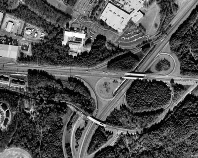
Above photo from Terraserver-USA.
Many locals simply refer to the Athens Perimeter as "The 10 Loop".
The "half diamond" interchange in the bottom is Old Hull Road, which was originally US 29/GA 8 until the original northern section of the Athens Perimeter was completed in the 1960's.
Northward is US 29/GA 8, going toward Danielsville. (Elberton is also a "control city", but the BGS doesn't tell you Elberton is accessible via GA 72, which ends at US 29/GA 8 just north of this interchange.)
Westward is US 129/441/GA 15/10 Loop/422, "control cities" being Commerce (US 441) and Jefferson (US 129). IMHO, Gainesville should be a control city as well, since Gainesville is a major city within Northeast Georgia and US 129 links both Athens and Gainesville.
Southward is US 29/129/441/GA 15/10 Loop/422, Control cities being Watkinsville and Madison. IMHO again, Lexington, Macon, and Augusta, should be "control cities" as well (or at least acknowledged when motorists approach US 78/GA 10 East (Lexington) and US 129/441/ GA 15 South (Macon/Augusta).
For more info on the Athens Perimeter, please visit both AARoads "Georgia Gateway" and Peach State Roads, both sites containing excellent road pics and historical details.
That's all for now. Thanks for visiting and please do so often.
Monday, January 30, 2006
Make Your Own Maps
I have just discovered the World66 website and their "Tools for Travelers".
From this website, I created the following maps...
First, here's a map of all the states I have visited throughout my lifetime...
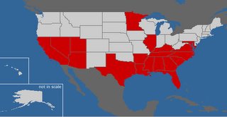
Next, here's a map of all the states visited where I have operated a motor vehicle...
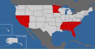
And finally, a map of the Canadian provinces I've visited...

On my next blog, I hope to officially debut my Clinched Interstates page.
Thanks for visiting and please do so often.
From this website, I created the following maps...
First, here's a map of all the states I have visited throughout my lifetime...

Next, here's a map of all the states visited where I have operated a motor vehicle...

And finally, a map of the Canadian provinces I've visited...
On my next blog, I hope to officially debut my Clinched Interstates page.
Thanks for visiting and please do so often.
Thursday, January 26, 2006
A Roadgeek Test
How much of a roadgeek are you?
Here's a little gem I found on misc.transport.road... The Great American Highways Quiz.
To take this quiz, please click here.
I had taken the quiz and got 8 of 10 correct. The ones I missed were the total number of rest areas on the Interstates and the very first Interstate route.
As for Georgia road news, I found a very interesting article regarding the plans to change GA 9 through Alpharetta and how city leaders want to be involved in Georgia DOT's planning process. Please click here to read the article from the Atlanta Journal-Constitution.
I travel this stretch most days when I head home from work, and during rush hour, it gets extremely congested from Old Milton Parkway (GA 120) northward to Milton Avenue (at Alpharetta City Hall). Hopefully, GDOT and the City of Alpharetta can hammer out some kind of agreement for the benefit of both the traveling public and their downtown area... but we'll see. (I could go on another "too much development" tirade, but I've beaten that horse to death already.)
Hope you enjoyed both the test and the article, thanks for visiting, and please come again.
Here's a little gem I found on misc.transport.road... The Great American Highways Quiz.
To take this quiz, please click here.
I had taken the quiz and got 8 of 10 correct. The ones I missed were the total number of rest areas on the Interstates and the very first Interstate route.
As for Georgia road news, I found a very interesting article regarding the plans to change GA 9 through Alpharetta and how city leaders want to be involved in Georgia DOT's planning process. Please click here to read the article from the Atlanta Journal-Constitution.
I travel this stretch most days when I head home from work, and during rush hour, it gets extremely congested from Old Milton Parkway (GA 120) northward to Milton Avenue (at Alpharetta City Hall). Hopefully, GDOT and the City of Alpharetta can hammer out some kind of agreement for the benefit of both the traveling public and their downtown area... but we'll see. (I could go on another "too much development" tirade, but I've beaten that horse to death already.)
Hope you enjoyed both the test and the article, thanks for visiting, and please come again.
Wednesday, January 25, 2006
Toll Roads and Bridges
Today on the Southeast Roads Yahoo! Newsgroup, Alex "Roaddog" Nitzman shared information regarding a feasibility study by Georgia's State Road and Tollway Authority for a tollway in Savannah. Please click here for the article.
Before the GA 400 tollway was opened in 1993, there had been a "Toll US 80" highway in the eastern part of Savannah running between the downtown area and Savannah Beach (now Tybee Island). I believe that the toll on that particular road was discontinued sometime around the early 1980's at the latest. If you have any history regarding "Toll US 80", then please share it with us.
The other tolled facility in Georgia was the F.J. Torras Causeway (unsigned Glynn County Route 582), which runs from US 17/GA 25 in Brunswick to Saint Simons Island. The toll ($0.35) was only charged for vehicles heading into Saint Simons. On December 31, 2003, the toll was discontinued and all that was left was an empty shell of a toll plaza with a plain white "NO TOLL" sign on it. I wish I had taken a picture of it when we were there nearly 2 years ago. :(
From 1953 to 1975, the original Eugene Talmadge Memorial Bridge in Savannah was tolled. Fortunately, the current bridge, which Mary and I traveled across last October while in Savannah, was free from the day it was opened to traffic. While we crossed the bridge, I took a CVS video recorder and recorded our trips as we drove over the bridge from Georgia to South Carolina (and back). I need to get it developed into a DVD.
A special thanks to Alex for sharing this Savannah toll road proposal news with us here in the road enthusiast community.
BTW, has anyone ever thought of doing another "roads meet" in Georgia? If so, then please let me know.
That's all for now. Thanks for visiting and please come back again.
Before the GA 400 tollway was opened in 1993, there had been a "Toll US 80" highway in the eastern part of Savannah running between the downtown area and Savannah Beach (now Tybee Island). I believe that the toll on that particular road was discontinued sometime around the early 1980's at the latest. If you have any history regarding "Toll US 80", then please share it with us.
The other tolled facility in Georgia was the F.J. Torras Causeway (unsigned Glynn County Route 582), which runs from US 17/GA 25 in Brunswick to Saint Simons Island. The toll ($0.35) was only charged for vehicles heading into Saint Simons. On December 31, 2003, the toll was discontinued and all that was left was an empty shell of a toll plaza with a plain white "NO TOLL" sign on it. I wish I had taken a picture of it when we were there nearly 2 years ago. :(
From 1953 to 1975, the original Eugene Talmadge Memorial Bridge in Savannah was tolled. Fortunately, the current bridge, which Mary and I traveled across last October while in Savannah, was free from the day it was opened to traffic. While we crossed the bridge, I took a CVS video recorder and recorded our trips as we drove over the bridge from Georgia to South Carolina (and back). I need to get it developed into a DVD.
A special thanks to Alex for sharing this Savannah toll road proposal news with us here in the road enthusiast community.
BTW, has anyone ever thought of doing another "roads meet" in Georgia? If so, then please let me know.
That's all for now. Thanks for visiting and please come back again.
Sunday, January 22, 2006
Road Enthusiasts... They're Everywhere!!!
Tonight, I had received an e-mail from my second cousin Dana in Douglasville, GA, complimenting me on my blogsite.
In that same e-mail, she mentioned that her husband David, an apparent road enthusiast himself, told her how the interstates are laid out. Here's the text verbatim...
My husband, David was just telling me an hour ago (while looking at my NAV in the car) that all interstates that run North-South are odd #d and West-East are Even #d and they they graduate in #s from one end of the country to the other end. I had no idea!! LOL Sounds like y'all have alot in common.
Dana, like my wife Mary, is an avid scrapbooker. In fact, she has her own scrapbooking place called Camp Crop-A-Lot. If you're into scrapbooking (or at least know someone who is), check out Dana's website.
Speaking of scrapbooks, Mary and I have decided to combine my love of "roadgeeking" and her love of scrapbooking to eventually produce a "roadgeek scrapbook". As soon as it gets completed, we'll let y'all know.
Dana and David, thanks for visiting "The Georgia Road Geek" and for your kind words. :)
That's all for now, folks. Thanks for visiting and please do so often.
In that same e-mail, she mentioned that her husband David, an apparent road enthusiast himself, told her how the interstates are laid out. Here's the text verbatim...
My husband, David was just telling me an hour ago (while looking at my NAV in the car) that all interstates that run North-South are odd #d and West-East are Even #d and they they graduate in #s from one end of the country to the other end. I had no idea!! LOL Sounds like y'all have alot in common.
Dana, like my wife Mary, is an avid scrapbooker. In fact, she has her own scrapbooking place called Camp Crop-A-Lot. If you're into scrapbooking (or at least know someone who is), check out Dana's website.
Speaking of scrapbooks, Mary and I have decided to combine my love of "roadgeeking" and her love of scrapbooking to eventually produce a "roadgeek scrapbook". As soon as it gets completed, we'll let y'all know.
Dana and David, thanks for visiting "The Georgia Road Geek" and for your kind words. :)
That's all for now, folks. Thanks for visiting and please do so often.
Friday, January 20, 2006
Controlled-Access Highways
On the newsgroup misc.transport.road, there was a discussion posted on how different states define expressways, freeways, and limited access.
I did a quick search of the Georgia Code and found the following:
'Controlled-access highway' means every highway, street, or roadway in respect to which owners or occupants of abutting lands and other persons have no legal right of access to or from the same except only at such points and in such manner as may be determined by the public authority having jurisdiction over such highway, street, or roadway. (Georgia Code 40-1-1(9))
On US 19/GA 400 just past its southernmost at-grade intersection (GA 369) and where I-575 becomes GA 515, there are actual green signs that denote the beginning and ending of access control. Please click here for an example (photo from the AARoads "Georgia Gateway" website).
There used to be "END LIMITED ACCESS" signs on US 78/GA 10 where the Stone Mountain Freeway ends in Gwinnett County, plus "END ACCESS CONTROL" signs on GA 316 and where I-985 becomes simply US 23/GA 365. On US 29/GA 8 just north of the northeastern quadrant of the Athens Perimeter, there was once an "END OF LIMITED ACCESS" sign.
The more common sign you will find at points where access control ends are yellow diamond warning signs saying "VEHICLES ENTERING AND CROSSING HIGHWAY".
If I could change this particular aspect of Georgia's highways, I would put simple yellow "END FREEWAY" warning signs like the ones I encountered while driving in southern California.
BTW, thanks to everyone who posted comments regarding "Roadgeeking... A Family Affair". It's nice to know that others care to involve their families, friends, and associates. The most recent example is from Alex "Roaddog" Nitzman, who has begun to indoctrinate his son into the roads hobby. We here at "The Georgia Road Geek" can't wait for his son's very first photo. :)
That's all for now. Thanks for visiting and please do so often.
I did a quick search of the Georgia Code and found the following:
'Controlled-access highway' means every highway, street, or roadway in respect to which owners or occupants of abutting lands and other persons have no legal right of access to or from the same except only at such points and in such manner as may be determined by the public authority having jurisdiction over such highway, street, or roadway. (Georgia Code 40-1-1(9))
On US 19/GA 400 just past its southernmost at-grade intersection (GA 369) and where I-575 becomes GA 515, there are actual green signs that denote the beginning and ending of access control. Please click here for an example (photo from the AARoads "Georgia Gateway" website).
There used to be "END LIMITED ACCESS" signs on US 78/GA 10 where the Stone Mountain Freeway ends in Gwinnett County, plus "END ACCESS CONTROL" signs on GA 316 and where I-985 becomes simply US 23/GA 365. On US 29/GA 8 just north of the northeastern quadrant of the Athens Perimeter, there was once an "END OF LIMITED ACCESS" sign.
The more common sign you will find at points where access control ends are yellow diamond warning signs saying "VEHICLES ENTERING AND CROSSING HIGHWAY".
If I could change this particular aspect of Georgia's highways, I would put simple yellow "END FREEWAY" warning signs like the ones I encountered while driving in southern California.
BTW, thanks to everyone who posted comments regarding "Roadgeeking... A Family Affair". It's nice to know that others care to involve their families, friends, and associates. The most recent example is from Alex "Roaddog" Nitzman, who has begun to indoctrinate his son into the roads hobby. We here at "The Georgia Road Geek" can't wait for his son's very first photo. :)
That's all for now. Thanks for visiting and please do so often.
Monday, January 16, 2006
Georgia's Covered Bridges
Today, I visited the Poole's Mill Bridge, a 1901 covered bridge near the Ducktown community of Forsyth County, Georgia. Here's the picture I took...
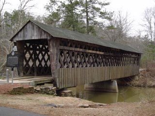
This is one of a mere handful of such structures that still exist throughout Georgia, and thank goodness that they are being preserved to give future generations a glimpse of the early pioneer roads and paths that linked people and places... way before the modern superhighways that we enjoy today.
The bridge is in Poole's Mill Park, owned and operated by the Forsyth County Parks and Recreation Department. (NOTE: The park's restrooms are closed for the winter. Otherwise, you may visit the park until sundown.)
These two road enthusiast sites also feature pictures of Georgia's covered bridges:
- Gribble Nation's Georgia Road Photos (Adam Prince)
- Peach State Roads Atlanta Northwest Photos (J.T. Legg)
The Georgia DOT also maintains a historic covered bridge website. (That's how I found out about the Poole's Mill Bridge, BTW.)
Kudos to Adam and J.T. for their respective websites and the hard work they put into them.
If you ever get a chance, visit a covered bridge near you. Whether or not you are a road enthusiast, I guarantee that you will appreciate the experience. I know I do.
That's all for now. Thanks for visiting and please do so often.
Friday, January 13, 2006
Roadgeeking... A Family Affair
Fellow road enthusiasts, did you know that "roadgeeking" can be fun for the whole family?
First of all, I got my wife Mary into it.
I even got my sister Laura and her husband Lib into it... at least while they were in Kazakhstan.
Today, I received an e-mail from my sister-in-law Fariha in Virginia, who, along with my brother Chris, have offered to take "lots and lots" of roadsign photos next time they're in Singapore and Malaysia (Fariha is originally from Singapore). Thanks, Chris and Fariha! :)
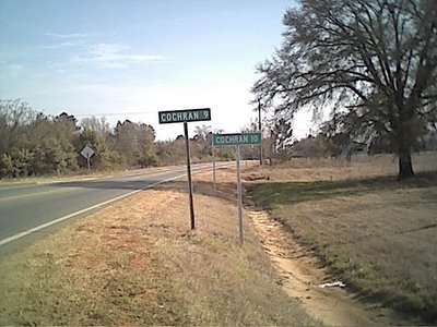
Yesterday, I received an e-mail from Joshua Jones, who found "The Georgia Road Geek" while looking for GA 400 exit information. He even included a very interesting photo that his mother, Alice Perkins of Cochran, GA, had taken while she was on her way home from work. Here's the photo:
First of all, I got my wife Mary into it.
I even got my sister Laura and her husband Lib into it... at least while they were in Kazakhstan.
Today, I received an e-mail from my sister-in-law Fariha in Virginia, who, along with my brother Chris, have offered to take "lots and lots" of roadsign photos next time they're in Singapore and Malaysia (Fariha is originally from Singapore). Thanks, Chris and Fariha! :)
Yesterday, I received an e-mail from Joshua Jones, who found "The Georgia Road Geek" while looking for GA 400 exit information. He even included a very interesting photo that his mother, Alice Perkins of Cochran, GA, had taken while she was on her way home from work. Here's the photo:
Conflicting distance signs on US 129 ALT in the Hartford community near Hawkinsville, GA (Photo taken by Alice Perkins)
Is Cochran 9 miles from this point... or is it 10? Perhaps someone at the Georgia DOT could not make up their minds when they put these signs on this stretch of highway... so they figured they both can be right and they all lived happily ever after. :)
Seriously, folks, the "COCHRAN 9" sign was eventually removed and the other remained... but fortunately, not before Alice took this picture for posterity. A very special "thank you" to both Alice and Joshua for sharing this excellent photo with "The Georgia Road Geek".
As you have seen, "roadgeeking" can be a family affair, so, my fellow road enthusiasts, see if you can get your family into it as well. If you have a similar story you wish to share with us, then please e-mail it to georgiaroadgeek at bellsouth dot net.
Thanks for visiting, have fun "roadgeeking", and please come back often.
Friday, January 06, 2006
GA 400 Scenes From This Week (Part II)
Fellow road enthusiats, the saga continues...
As you may remember from last time (Part I), we entered Forsyth County, where the GA 400 mileposts reset to zero. Now, here's "Mile 1", located just before McFarland Road East (Exit 12A)...
As you may remember from last time (Part I), we entered Forsyth County, where the GA 400 mileposts reset to zero. Now, here's "Mile 1", located just before McFarland Road East (Exit 12A)...
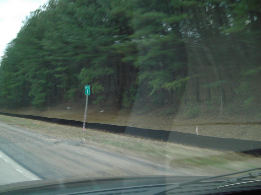 And now... here's your "roadgeek treat"... another GDOT "sign goof"...

Apparently, it must be 23 miles between McFarland Road East (Exit 12A) and McFarland Road West (Exit 12B). Either that or someone didn't tell the contractor that mile markers were reset just after entering Forsyth County.
Hope y'all enjoyed it. :)
Thanks for visiting and please come again.
GA 400 Scenes From This Week (Part I)
Fellow road enthusiasts...
This week, I decided to pack our second digital camera (the "cheapie" that we got free for getting BellSouth DSL) in the truck for some GA 400 "roadgeeking" during the commute home.
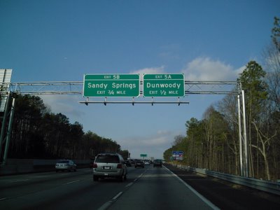
First, here is a picture of a new BGS overhead for Exits 5A-B (Abernathy Road) at the 1/2-mile (800 m) point...
This week, I decided to pack our second digital camera (the "cheapie" that we got free for getting BellSouth DSL) in the truck for some GA 400 "roadgeeking" during the commute home.
First, here is a picture of a new BGS overhead for Exits 5A-B (Abernathy Road) at the 1/2-mile (800 m) point...
As you may know by now, GA 400 will be widened between Holcomb Bridge and McFarland Roads. Here are photos for the GA 400 northbound lane shift that begins at Holcomb Bridge Road (GA 140)...
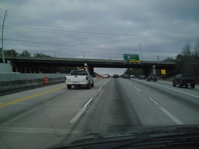


Here's a photo showing how traffic "bottles up" just 1 mile (1.6 km) before Haynes Bridge Road (notice the covered-up arrow)...

Here is where the northbound lane shifts will be ending for now...
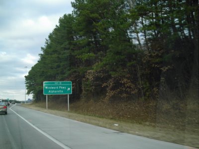
This has been the northern end of the section of shoulder buses are allowed to use if traffic slows below 35 MPH (55 km/h).
Finally, here are the northbound pictures from Forsyth County, starting with the point at the county line where the mileposts reset to zero...

On "Part II", I'll continue the pictures through McFarland Road and I will have a very special "roadgeek treat" for y'all.
That's all for now. Thanks for visiting and please come again.
Wednesday, January 04, 2006
We're Now On Mob-Rule
Fellow road enthusiasts, my wife and I just got our Mob-Rule user IDs.
She is "flagal" (for "Florida Gal") and I am, of course, "georgiaroadgeek".
Again, being an unabashed roadgeek, I enjoy driving the roads of places I have visited and do so whenever possible.
Here are the map URLs for each state and each county where I have driven a motor vehicle:
Alabama
California
Florida
Georgia
Minnesota
Mississippi
Nevada
North Carolina
South Carolina
Tennessee
Thanks to Mike Nix (Mob-Rule ID "michaelj" and currently ranked #2 on Mob-Rule), Alex "Roaddog" Nitzman (Mob-Rule ID "aaroads"), and Michael Adams for their additional encouragement and feedback regarding our newfound endeavors.
A final "thank you" to my brother-in-law Lib for his blog about my blogsite. He's right about my lifelong obsession with roads and road-related stuff. :)
That's all for tonight. Thanks for visiting and please do so often.
She is "flagal" (for "Florida Gal") and I am, of course, "georgiaroadgeek".
Again, being an unabashed roadgeek, I enjoy driving the roads of places I have visited and do so whenever possible.
Here are the map URLs for each state and each county where I have driven a motor vehicle:
Alabama
California
Florida
Georgia
Minnesota
Mississippi
Nevada
North Carolina
South Carolina
Tennessee
Thanks to Mike Nix (Mob-Rule ID "michaelj" and currently ranked #2 on Mob-Rule), Alex "Roaddog" Nitzman (Mob-Rule ID "aaroads"), and Michael Adams for their additional encouragement and feedback regarding our newfound endeavors.
A final "thank you" to my brother-in-law Lib for his blog about my blogsite. He's right about my lifelong obsession with roads and road-related stuff. :)
That's all for tonight. Thanks for visiting and please do so often.
Monday, January 02, 2006
Countdown To "D-Day" On GA 400
Fellow road enthusiasts, it's the countdown to "D-Day" on US 19/GA 400.
On Tuesday, January 3, 2006, at 9 PM, the Georgia DOT (GDOT) will start the lane shifts on US 19/GA 400 northbound between Holcomb Bridge Road (Exits 7A-B) and Windward Parkway (Exit 11). The southbound lane shifts will start Wednesday night at 9 PM.
For more info, please click here for the article from the Atlanta Journal-Constitution.
Since just after Thanksgiving, GDOT has had mobile signs along GA 400 warning drivers that there will be construction activity from 9 PM until 5 AM.
This is the start of the much-needed widening of GA 400 between Holcomb Bridge Road in Roswell to McFarland Road (Exits 12A-B North, Exit 12 South) in south Forsyth County.
The good news is that this will not be a tolled "public-private initiative" project. :)
GDOT estimates a September, 2007, completion date. Still, this has been looooong overdue.
That's all for now. Thanks for visiting and please come back again.
On Tuesday, January 3, 2006, at 9 PM, the Georgia DOT (GDOT) will start the lane shifts on US 19/GA 400 northbound between Holcomb Bridge Road (Exits 7A-B) and Windward Parkway (Exit 11). The southbound lane shifts will start Wednesday night at 9 PM.
For more info, please click here for the article from the Atlanta Journal-Constitution.
Since just after Thanksgiving, GDOT has had mobile signs along GA 400 warning drivers that there will be construction activity from 9 PM until 5 AM.
This is the start of the much-needed widening of GA 400 between Holcomb Bridge Road in Roswell to McFarland Road (Exits 12A-B North, Exit 12 South) in south Forsyth County.
The good news is that this will not be a tolled "public-private initiative" project. :)
GDOT estimates a September, 2007, completion date. Still, this has been looooong overdue.
That's all for now. Thanks for visiting and please come back again.
Sunday, January 01, 2006
"County Counting"
Recently, my wife and I found a "county counting" website called Mob Rule, where you can create maps documenting each county within the U.S. that you have ever set foot into.
My wife has decided to document each county that she has physically been in, but being the roadgeek that I am, I have decided to document only those counties I have actually driven either through or into.
For instance, here is a map (generated from Mob Rule) showing which Georgia counties (shaded in blue) I have actually driven either through or into:
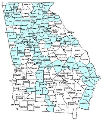
I also have created maps of counties I have driven either through or into for the following additional states: Alabama, California, Florida, Minnesota, Mississippi, Nevada, North Carolina, South Carolina, and Tennessee.
If I were to count other counties that I have set foot into, I could count counties in Alabama, Arkansas, Arizona, California (Riverside), Florida, the District of Columbia, Georgia, Illinois, Kentucky, Louisiana, Maryland, Nevada, Tennessee, Texas, Utah, and Virginia.
Outside of the U.S., I can count every Ontario county and region on the Queen Elizabeth Way between Toronto and Niagara Falls. (While we were there, we took either public transit or tour buses.)
The whole idea of "county counting" actually came from Mike, a Toastmaster friend of ours who works as a county extension agent and has pursued this hobby for several years. He's so good at counties, he can tell you right off the top of his head the exact number of counties there are in the U.S. (Thanks, Mike, for your inspiration.)
As I add more "driven-through" counties to my collection, I'll let you know.
That's all for now. Thanks for visiting and please come back again.
My wife has decided to document each county that she has physically been in, but being the roadgeek that I am, I have decided to document only those counties I have actually driven either through or into.
For instance, here is a map (generated from Mob Rule) showing which Georgia counties (shaded in blue) I have actually driven either through or into:
I also have created maps of counties I have driven either through or into for the following additional states: Alabama, California, Florida, Minnesota, Mississippi, Nevada, North Carolina, South Carolina, and Tennessee.
If I were to count other counties that I have set foot into, I could count counties in Alabama, Arkansas, Arizona, California (Riverside), Florida, the District of Columbia, Georgia, Illinois, Kentucky, Louisiana, Maryland, Nevada, Tennessee, Texas, Utah, and Virginia.
Outside of the U.S., I can count every Ontario county and region on the Queen Elizabeth Way between Toronto and Niagara Falls. (While we were there, we took either public transit or tour buses.)
The whole idea of "county counting" actually came from Mike, a Toastmaster friend of ours who works as a county extension agent and has pursued this hobby for several years. He's so good at counties, he can tell you right off the top of his head the exact number of counties there are in the U.S. (Thanks, Mike, for your inspiration.)
As I add more "driven-through" counties to my collection, I'll let you know.
That's all for now. Thanks for visiting and please come back again.
Holiday Roadgeeking 2005
Happy New Year, fellow road enthusiasts!!!
During the Christmas holiday, Mary and I went down to Florida to visit her family.
While we were there (and traveling to and from Florida), we even did some "roadgeeking" and "cinched" Florida's Polk Parkway toll road (FL 570). Here's a photo of the Polk Parkway BGS just after entering from I-4 just northeast of Lakeland:
During the Christmas holiday, Mary and I went down to Florida to visit her family.
While we were there (and traveling to and from Florida), we even did some "roadgeeking" and "cinched" Florida's Polk Parkway toll road (FL 570). Here's a photo of the Polk Parkway BGS just after entering from I-4 just northeast of Lakeland:

On our way to Florida, we got stuck on I-75 southbound near the merge with I-675 and we were crawling all the way to just south of McDonough. On the way home from Florida, the northbound I-75 traffic really stunk, too, all the way from just south of McDonough all the way to the I-675 split. Here's a photo we took on I-75 southbound near GA 138 (Exit 228) around 3 PM just 3 days before Christmas:
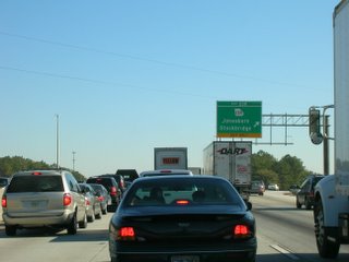
It seems that no matter what time of the day (or even time of the year), everytime we're on I-75 between Stockbridge and McDonough, the traffic just stinks. :(
I-75 between Tifton and Valdosta was a major mess, too, as Georgia DOT (GDOT) had it torn up for the ongoing widening projects. Parts of it between Tifton and Valdosta were narrowed down and the speed limit was 60 MPH (100 km/h). I'm looking forward to seeing it completed and hopefully, by the time we head to Florida next Christmas, the streches currently being widened will be.
Kudos to GDOT for suspending road work during the holidays, though. :)
That's all for now. May you and yours have a very happy and prosperous 2006, thanks for reading and supporting "The Georgia Road Geek", and please come back again.
Wednesday, December 21, 2005
Holiday Wishes To You
Dear Fellow Road Enthusiasts,
Whichever holiday you choose to celebrate and observe, I wish you...
- A Merry Christmas
- A Happy Hannukah
- A Happy Kwanzaa
Whichever holiday you choose to celebrate and observe, I wish you...
- A Merry Christmas
- A Happy Hannukah
- A Happy Kwanzaa
If I have forgotten a holiday that you choose to celebrate and observe during this time of the year, then I hope that it is a happy one for you.
Thank you for reading and supporting "The Georgia Road Geek" and may you have a safe and Happy New Year!!!
Saturday, December 17, 2005
Rediscovering Roadgeeking
Dear Fellow Road Enthusiasts,
When I decided to start a "roadgeek blog" of my own, I never imagined that it would be such a hit.
For the last 3 years, I was heavily involved in my other great love, Toastmasters. During this time, I was the Georgia Toastmasters District's Lt. Governor and finally District Governor.
On July 1, 2005, I officially became a "has been" and that freed me up to take up other hobbies that I enjoy... especially "roadgeeking". I am still active in my local Toastmasters chapter in the Atlanta area, but I'm just a member now. Oh, what a feeling!!! :)
My love of "roadgeeking" was rekindled in late August, when my wife Mary and I were in Toronto for the Toastmasters International convention. During our trip there, I decided to put our new digital camera to work by taking some road sign photos. Since that was the first time we ever went to Canada, I figured that I'd be cheating myself if I didn't "roadgeek" some.
Not long after coming back to Atlanta, I decided to do something different in terms of my "roadgeeking". That's when I decided to do a "blogsite" (with some inspiration from my brother-in-law, who had been blogging for a while himself).
First, I went to Blogger and set up this blogsite. Second, I went to Yahoo! Small Business and purchased the domain name georgiaroadgeek.com. Finally, I started blogging, and (pardon the cliche) the rest is history. :)
Now, here are some acknowledgements..
First, I want to thank my brother-in-law Lib for inspiring me to blog in the first place. Incidentally, he and my sister Laura had taken the world's only known "roadgeek" pictures from Kazakhstan while they were there to adopt their lovely daughter (my niece) Stella.
"CTON" is Russian for "STOP".
Second, I want to thank fellow road enthusiasts Geoff Hatchard, Pete Jenior, Adam Prince, J.T. Legg, Marc Fannin, "Froggie", Andy Field, Alex "Roaddog" Nitzman, and the rest of the road enthusiast community worldwide for supporting "The Georgia Road Geek".
Finally, I want to thank the love of my life and my best friend in the whole wide world... my lovely wife Mary. No matter what, she is always there to give me love, support, and encouragement. Honey, I love you more than anything else in the world! :)
That's all for today. Thanks always for visiting "The Georgia Road Geek" and please do so often.
When I decided to start a "roadgeek blog" of my own, I never imagined that it would be such a hit.
For the last 3 years, I was heavily involved in my other great love, Toastmasters. During this time, I was the Georgia Toastmasters District's Lt. Governor and finally District Governor.
On July 1, 2005, I officially became a "has been" and that freed me up to take up other hobbies that I enjoy... especially "roadgeeking". I am still active in my local Toastmasters chapter in the Atlanta area, but I'm just a member now. Oh, what a feeling!!! :)
My love of "roadgeeking" was rekindled in late August, when my wife Mary and I were in Toronto for the Toastmasters International convention. During our trip there, I decided to put our new digital camera to work by taking some road sign photos. Since that was the first time we ever went to Canada, I figured that I'd be cheating myself if I didn't "roadgeek" some.
Not long after coming back to Atlanta, I decided to do something different in terms of my "roadgeeking". That's when I decided to do a "blogsite" (with some inspiration from my brother-in-law, who had been blogging for a while himself).
First, I went to Blogger and set up this blogsite. Second, I went to Yahoo! Small Business and purchased the domain name georgiaroadgeek.com. Finally, I started blogging, and (pardon the cliche) the rest is history. :)
Now, here are some acknowledgements..
First, I want to thank my brother-in-law Lib for inspiring me to blog in the first place. Incidentally, he and my sister Laura had taken the world's only known "roadgeek" pictures from Kazakhstan while they were there to adopt their lovely daughter (my niece) Stella.

"CTON" is Russian for "STOP".
Second, I want to thank fellow road enthusiasts Geoff Hatchard, Pete Jenior, Adam Prince, J.T. Legg, Marc Fannin, "Froggie", Andy Field, Alex "Roaddog" Nitzman, and the rest of the road enthusiast community worldwide for supporting "The Georgia Road Geek".
Finally, I want to thank the love of my life and my best friend in the whole wide world... my lovely wife Mary. No matter what, she is always there to give me love, support, and encouragement. Honey, I love you more than anything else in the world! :)
That's all for today. Thanks always for visiting "The Georgia Road Geek" and please do so often.
Friday, December 16, 2005
"Georgia Road Geek" News - 12/16/2005
"411 Connector" Update
According to a Rome, GA, radio station website I came across yesterday while "Googling" for "411 connector" (I forgot the actual station name.), here is the latest news I have:
If all goes according to Georgia DOT's schedule, the land acquistion for the "411 Connector" in Bartow County will begin in 2006.
Actual construction may not begin until 2007 and completion may not be until 2010 at the earliest.
Georgia's First PPI Approved By DOT
Yesterday, the Georgia DOT's State Transportation Board unanimously approved the Public-Private Initiative (PPI) proposal from a consortium called Georgia Transportation Partners to add toll lanes along the Northwest Corridor (I-75/I-575 in Cobb and Cherokee Counties).
This will be Georgia's very first PPI. To learn more, please click here for the GDOT's official press release.
That's all for now. Thanks for visiting and please do so often.
According to a Rome, GA, radio station website I came across yesterday while "Googling" for "411 connector" (I forgot the actual station name.), here is the latest news I have:
If all goes according to Georgia DOT's schedule, the land acquistion for the "411 Connector" in Bartow County will begin in 2006.
Actual construction may not begin until 2007 and completion may not be until 2010 at the earliest.
Georgia's First PPI Approved By DOT
Yesterday, the Georgia DOT's State Transportation Board unanimously approved the Public-Private Initiative (PPI) proposal from a consortium called Georgia Transportation Partners to add toll lanes along the Northwest Corridor (I-75/I-575 in Cobb and Cherokee Counties).
This will be Georgia's very first PPI. To learn more, please click here for the GDOT's official press release.
That's all for now. Thanks for visiting and please do so often.
Wednesday, December 14, 2005
Aerial Road Shot of the Week - US 41/411 Interchange
For the latest installment of "The Georgia Road Geek" Aerial Road Shot of the Week, we give you the US 41/GA 3 and US 411/GA 20 interchange near Cartersville (Bartow County):
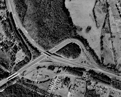
Above Photo From Terraserver-USA.
This trumpet-style interchange was built around 1960 as the easternmost portion of a 4-lane divided highway (no access control) running from Cartersville to US 27/GA 1/53 in Rome (Floyd County).
The 4-lane divided highway in the southwestern corner is US 411 South/GA 20 West, which runs westward for 20 miles (32 km) to US 27/GA 1/53 in Rome. This particular stretch of highway was originally co-signed with US 411 as GA 344 until the mid 1970's.
US 41/GA 3 is the 4-lane divided highway that runs from northwest to southeast. US 41/GA 3 and US 411/GA 20 share pavement for 3 miles (5 km), where it meets GA 61. From there, US 411 joins GA 61 northward to the Tennessee state line and GA 20 splits eastward toward Canton (Cherokee County).
Future plans for this interchange are to tie in a brand new 4-lane divided highway with limited access that will extend the US 411/GA 20 4-lane highway to I-75 at GA 20 (Exit 290). This will be known as the "411 Connector". To see the route that the Georgia DOT (GDOT) has apparently chosen as of December 1, 2005, please click here for a detailed aerial map on their website.
The purpose of the "411 Connector", which was originally conceived in 1986 and later became part of the now-defunct "Northern Arc", will be to give both Atlanta and Rome direct high-speed access.
Based on my observations of the proposed route and design, it looks like the "411 Connector" would be up to Interstate standards from the existing US 411 4-lane to I-75. In that case, perhaps GDOT could designate this short stretch as I-375 (similar to either Alabama's I-359 in Tuscaloosa or I-759 in Gadsden).
Furthermore, perhaps GDOT could consider upgrading the existing US 411 4-lane between US 41/GA 3 and US 27/GA 1/53 in Rome to a full-blown Interstate, thus giving Rome it's own Interstate highway similar to Columbus's I-185.
Unlike the proposed I-3 in eastern and northeast Georgia, this highway IMHO is truly needed for giving Rome/Floyd County much better access to Atlanta as GA 316 did with Athens/Clarke County. My only hope, though, is that the developers don't get too greedy along the US 411 corridor, but given their track record and north Georgia's overall growth, I wouldn't bet the farm on it.
That's all for now. Thanks for visiting and please do so often.
Tuesday, December 13, 2005
STOP I-3!!!
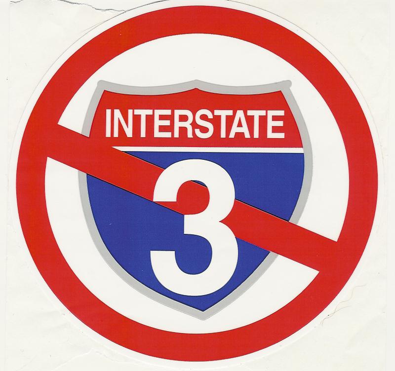
This afternoon, I received the above "STOP I-3" sticker from an acquaintance in Hiawassee, Georgia, located in the Blue Ridge Mountains of northeast Georgia near the North Carolina state line.
For those of you who may not know, there is a proposal to build an Interstate 3 (a.k.a. "The 3rd Infantry Division Highway") from Savannah, Georgia, to Knoxville, Tennessee. For more information on this proposed highway, please see AARoads Interstate Guide I-3 webpage.
Like many proposed routes, "economic development" is used as the justification, but several residents in Hiawassee, which will be in the path of I-3, are already rallying against the road due to the potential environmental damage it could bring to the Appalachian Mountains of Georgia, North Carolina, and Tennessee. The Stop I-3 Coalition was formed for this purpose.
Even though I am a road enthusiast, I am not really sure that I-3 would serve any real purpose. Hiawassee is already benefitting from the increasing number of retirees that move there for the peace and quiet, thus I feel the "economic development" argument does not quite hold water.
If we have any more news on the I-3 plans, then we will share them with you.
What are your thoughts? Pro or con, please feel free to post them here at "The Georgia Road Geek" (please keep the comments polite, however).
BTW, "STOP I-3" bumper and window stickers are available through the coalition's website.
That's all for now. Thanks for visiting and please come back again.
Saturday, December 10, 2005
Aerial Road Shot of the Week - 12/10/2005
Dear Fellow Road Enthusiasts,
After taking some "virtual trips" on some of Georgia's highways via Terraserver-USA, plus being inspired by Michael Adams's "Highway Heaven" aerial shot features, I decided to start an "Aerial Road Shot of the Week".
These will feature various highways throughout the State of Georgia.
This week's feature is an aerial shot of the interchange between US 23/GA 365 and US 441/GA 15 in Cornelia.

Above image obtained from Terraserver USA website.
From this point northward, US 23 and US 441 share pavement until they reach Sylva, North Carolina.
US 23/441 from Cornelia to the North Carolina state line make up the northernmost portion of Georgia's US 441 Governor's Road Improvement Program (GRIP) corridor (GDOT Project EDS-441). This GRIP corridor runs southward along US 441 to the Florida state line.
To the southwest of this interchange, US 23/GA 365 takes you to Gainesville, where, at the interchange with US 129 North/GA 369 (Exit 24), it becomes I-985.
Please let us know if you enjoy this feature and feel free to make your own suggestions for our "Aerial Road Shot of the Week" by e-mailing georgiaroadgeek at bellsouth dot net. As a token of our appreciation, we'll even mail you an official "Georgia Road Geek" magnet if you give us your postal address. :)
Thanks for visiting and please do so often.
A Private Proposal For GA 400
This past week, while reading the Atlanta Journal-Constitution's (AJC) Metro section online, I came across yet another proposal for a private consortium to fix our roads and attach tolls to do so.
The Washington Group, who proposed the controversial upgrade of GA 316 from Lawrenceville to Athens as a toll expressway, now has their eyes on US 19/GA 400. Please click here for the AJC article.
Right now, the Georgia DOT is preparing to widen US 19/GA 400 from Holcomb Bridge Road (Exits 7A-B) in Roswell to McFarland Road (Exits 12A-B) in Forsyth County. Considering the bottleneck we, 400's "regulars", experience every day on 400 in that stretch of road, it's about time!!!
Under the Washington Group's plan, the existing project would be enhanced to add toll lanes all the way to GA 20 (Exit 14) in Cumming and issue drivers transponders that would track their usage and bill them accordingly.
And now, here are my thoughts...
While I am for transportation projects being completed as soon as possible, I have major problems with private companies essentially taking over public roads and charging tolls for us to drive on them.
First of all, the transponders would be giving "big brother" way too much information from the standpoint of collecting data on our driving. If the technology enables the government (or any private firm) to collect tolls, then what stops them from enhancing it to track other things? In other words, our own civil liberties could be potentially compromised with this technology. Think about it.
Second, as for toll roads in general, the government should just build them from scratch such as what was done with the section of GA 400 from I-85 to I-285. Even then, once the tolls have paid for any bond indebtedness incurred by the government, the tolls should be immediately removed. At the end of 2003, Georgia did remove the toll from the F.J. Torras Causeway that runs between Brunswick and Saint Simons Island.
Finally, the government should do something about what is causing the need to expand the roads... overdevelopment. Please click here to read my thoughts from a previous blog.
What are your thoughts?
Thanks again for visiting and please come back again.
The Washington Group, who proposed the controversial upgrade of GA 316 from Lawrenceville to Athens as a toll expressway, now has their eyes on US 19/GA 400. Please click here for the AJC article.
Right now, the Georgia DOT is preparing to widen US 19/GA 400 from Holcomb Bridge Road (Exits 7A-B) in Roswell to McFarland Road (Exits 12A-B) in Forsyth County. Considering the bottleneck we, 400's "regulars", experience every day on 400 in that stretch of road, it's about time!!!
Under the Washington Group's plan, the existing project would be enhanced to add toll lanes all the way to GA 20 (Exit 14) in Cumming and issue drivers transponders that would track their usage and bill them accordingly.
And now, here are my thoughts...
While I am for transportation projects being completed as soon as possible, I have major problems with private companies essentially taking over public roads and charging tolls for us to drive on them.
First of all, the transponders would be giving "big brother" way too much information from the standpoint of collecting data on our driving. If the technology enables the government (or any private firm) to collect tolls, then what stops them from enhancing it to track other things? In other words, our own civil liberties could be potentially compromised with this technology. Think about it.
Second, as for toll roads in general, the government should just build them from scratch such as what was done with the section of GA 400 from I-85 to I-285. Even then, once the tolls have paid for any bond indebtedness incurred by the government, the tolls should be immediately removed. At the end of 2003, Georgia did remove the toll from the F.J. Torras Causeway that runs between Brunswick and Saint Simons Island.
Finally, the government should do something about what is causing the need to expand the roads... overdevelopment. Please click here to read my thoughts from a previous blog.
What are your thoughts?
Thanks again for visiting and please come back again.
Wednesday, December 07, 2005
GA DOT Plans I-16/I-75 Overhaul In Macon
As posted on the Yahoo! Group seroads by "Dino H." of Macon, GA...
After major accidents, major bottlenecks, immense and growing traffic counts for a rapidly growing area in middle Georgia, GADOT finally has come up with THEhuge idea to fix the one of the major traffic issuesof the area. Plus it solves the issue of widening onI-16 and I-75. The US 129 / Spring St, Colisium Driveand Second St interstate access and merge problemswill be solved effectively dispersing the trafficevenly on three raods from two. (MAjor reconstruction! Lots of fill needed.) HUGE NEWS!Can't wait to see the start... it may takes some timeto it is being address.
OTHER NEWS for MACON - I-75 will also be widened from Pierce to Arkwright Rd... not shown on the website. Meeting thurs at GAdot in Macon Riverside Dr. ThePierce RD current access will be removed from thesouthbound side of I-75. Rumors say there will be anew interchange a mile north... we'll see at the meeting and I'll forward the info to you. Northbound Pierce will be partially reconstructed but remain the same.
For more info, please click here for the official I-16/I-75 project website.
Having travelled this section of Georgia interstate off-an-on for years, I wholeheartedly agree that it is time for a major, major overhaul of the freeway system in Macon. IMHO, it has been extremely overdue for at least 20 years!!!
A very special "thank you" to Dino for sharing this info with the road enthusaist community and we look forward to further reports from him. :)
That's all for now. Thanks for visiting and please do so often.
After major accidents, major bottlenecks, immense and growing traffic counts for a rapidly growing area in middle Georgia, GADOT finally has come up with THEhuge idea to fix the one of the major traffic issuesof the area. Plus it solves the issue of widening onI-16 and I-75. The US 129 / Spring St, Colisium Driveand Second St interstate access and merge problemswill be solved effectively dispersing the trafficevenly on three raods from two. (MAjor reconstruction! Lots of fill needed.) HUGE NEWS!Can't wait to see the start... it may takes some timeto it is being address.
OTHER NEWS for MACON - I-75 will also be widened from Pierce to Arkwright Rd... not shown on the website. Meeting thurs at GAdot in Macon Riverside Dr. ThePierce RD current access will be removed from thesouthbound side of I-75. Rumors say there will be anew interchange a mile north... we'll see at the meeting and I'll forward the info to you. Northbound Pierce will be partially reconstructed but remain the same.
For more info, please click here for the official I-16/I-75 project website.
Having travelled this section of Georgia interstate off-an-on for years, I wholeheartedly agree that it is time for a major, major overhaul of the freeway system in Macon. IMHO, it has been extremely overdue for at least 20 years!!!
A very special "thank you" to Dino for sharing this info with the road enthusaist community and we look forward to further reports from him. :)
That's all for now. Thanks for visiting and please do so often.
Saturday, December 03, 2005
GDOT Removes Erroneous Distance Sign
Yesterday as I was heading north on US 19/GA 400, I noticed that the Georgia DOT (GDOT) removed the erroneous "Roswell 9/Dahlonega 26" distance sign between Exits 6 (Northridge Road) and 7A (GA 140/Holcomb Bridge Road/Norcross).
I'm not sure if GDOT read the blog or otherwise someone else reported it to them, but "The Georgia Road Geek" was the first place on the Internet to bring you a report and picture of the erroneous distance sign in question. (See my blog entry "The New GA 400 Signs Are Here!!!".)
The correct sign should read "Roswell 5/Dahlonega 43" just like the old button-copy sign it replaced (picture from AARoads "Georgia Gateway").
Finally, a reminder that official "Georgia Road Geek" magnets are available. Please click here for more info.
That's all for now. Thanks for visiting and please come back again.
I'm not sure if GDOT read the blog or otherwise someone else reported it to them, but "The Georgia Road Geek" was the first place on the Internet to bring you a report and picture of the erroneous distance sign in question. (See my blog entry "The New GA 400 Signs Are Here!!!".)
The correct sign should read "Roswell 5/Dahlonega 43" just like the old button-copy sign it replaced (picture from AARoads "Georgia Gateway").
Finally, a reminder that official "Georgia Road Geek" magnets are available. Please click here for more info.
That's all for now. Thanks for visiting and please come back again.
Wednesday, November 30, 2005
A Very Special New Sign In Georgia
This afternoon, as I drove along I-285 and US 19/GA 400, I saw a very special new roadsign...
Sandy Springs - City Limit (replacing the old signs that said "Sandy Springs - Unincorporated").
At 12:00 AM on December 1, 2005, Georgia's newest (and seventh largest) city, Sandy Springs, will be born.
Until now, Sandy Springs has been an unincorporated area within north Fulton County. As a result of ever-growing discontent with the Fulton County Government, the residents of Sandy Springs "seceded" from Fulton County via an act of the 2005 Georgia General Assembly and a referendum where the vast majority voted in favor of cityhood.
To read more about this history-making event, please click here.
Please join me in congratulating the citizens and leaders of the brand new City of Sandy Springs, Georgia. We here at "The Georgia Road Geek" wish them all the best in this history-making endeavor.
That's all for now. Thanks for visiting and please come back soon.
Sandy Springs - City Limit (replacing the old signs that said "Sandy Springs - Unincorporated").
At 12:00 AM on December 1, 2005, Georgia's newest (and seventh largest) city, Sandy Springs, will be born.
Until now, Sandy Springs has been an unincorporated area within north Fulton County. As a result of ever-growing discontent with the Fulton County Government, the residents of Sandy Springs "seceded" from Fulton County via an act of the 2005 Georgia General Assembly and a referendum where the vast majority voted in favor of cityhood.
To read more about this history-making event, please click here.
Please join me in congratulating the citizens and leaders of the brand new City of Sandy Springs, Georgia. We here at "The Georgia Road Geek" wish them all the best in this history-making endeavor.
That's all for now. Thanks for visiting and please come back soon.
Monday, November 28, 2005
Get Your Official "Georgia Road Geek" Magnet

Be the first one on your block to sport an official "Georgia Road Geek" magnet (shown above) on your refrigerator, cubicle, or other place you like to stick magnets.
To order (limit one per request), please send a self-addressed stamped envelope (SASE) to the following postal address:
The Georgia Road Geek
P.O. Box 1002
Alpharetta, GA 30009-1002
INTERNATIONAL ORDERS: Please enclose either an International Reply Coupon or US$1.00 with your self-addressed envelope to cover postage and handling costs.
All requests will be processed ASAP, but please allow 4 weeks for delivery.
Thank you in advance for your request and always your support of "The Georgia Road Geek".
Wednesday, November 23, 2005
Happy Thanksgiving
Have a Happy Thanksgiving and may your travels be pleasant and safe.
Thanks for visiting and please do so often.
Thanks for visiting and please do so often.
Saturday, November 19, 2005
Interstate 14 - My Proposed Route
Last night, while visiting the Yahoo! Groups seroads discussion group, I went over to the link section and surfed the Alabama DOT (ALDOT) website.
While I was there, I noticed that ALDOT had a section regarding a proposal to extend I-85 from I-65 to I-20/59 along the US 80/AL 8 corridor.
According to the AARoads Interstate Guide website, this was supposed to be a part of a Congressionally proposed Interstate 14 corridor that would run through the "Black Belt" of Louisiana, Mississippi, Alabama, Georgia and South Carolina. Please click here for the proposal from the official website of Georgia Congressman Charlie Norwood.
For years before this proposal was made, I had originally envisioned Interstate 14, a route that would start at I-85 in eastern Alabama near Tuskegee, parallel US 80 from there to Phenix City, and into Georgia through Columbus, Macon/Warner Robins, and ending just west of Augusta at I-20 in Columbia County. This would be my own "Fall Line Freeway".
Based on ALDOT's proposed I-85 extension, I think it would make sense to keep it as part of the proposed I-14 corridor, with I-14 using the southern Montgomery bypass freeway (AL 108)as part of its route and I-14 and I-85 sharing pavement eastward until you reach the Tuskegee area. At that point, I-14 would run along a new route (parallelling US 80/AL 8) that would tie it into the existing Phenix City/Columbus northern bypass. Please click here for an ALDOT PDF file of the proposed I-85 extension study area.
Here are images of my own I-14 Georgia route proposal as drawn on an official Georgia road map (my proposed route is in pink highlighter):
While I was there, I noticed that ALDOT had a section regarding a proposal to extend I-85 from I-65 to I-20/59 along the US 80/AL 8 corridor.
According to the AARoads Interstate Guide website, this was supposed to be a part of a Congressionally proposed Interstate 14 corridor that would run through the "Black Belt" of Louisiana, Mississippi, Alabama, Georgia and South Carolina. Please click here for the proposal from the official website of Georgia Congressman Charlie Norwood.
For years before this proposal was made, I had originally envisioned Interstate 14, a route that would start at I-85 in eastern Alabama near Tuskegee, parallel US 80 from there to Phenix City, and into Georgia through Columbus, Macon/Warner Robins, and ending just west of Augusta at I-20 in Columbia County. This would be my own "Fall Line Freeway".
Based on ALDOT's proposed I-85 extension, I think it would make sense to keep it as part of the proposed I-14 corridor, with I-14 using the southern Montgomery bypass freeway (AL 108)as part of its route and I-14 and I-85 sharing pavement eastward until you reach the Tuskegee area. At that point, I-14 would run along a new route (parallelling US 80/AL 8) that would tie it into the existing Phenix City/Columbus northern bypass. Please click here for an ALDOT PDF file of the proposed I-85 extension study area.
Here are images of my own I-14 Georgia route proposal as drawn on an official Georgia road map (my proposed route is in pink highlighter):
From Phenix City, AL, I-14 would use the existing US 80 Columbus/Phenix City northern bypass (known as J.R. Allen Parkway in Georgia), the northeasternmost part of the Columbus-Manchester Expressway (US 27 Alt/GA 85) into Harris County, then just south of Waverly Hall, it would proceed eastward, paralleling US 80/GA 22 all the way to I-75.
I-14 would cross I-75 just south of Hartley Bridge Road (I-75 Exit 155) in Bibb County, putting it between the downtown areas of Macon and Warner Robins.
From I-75, I-14 would proceed into Twiggs County, where it would cross I-16 and then go northeastward toward US 441 /GA 29, crossing it just south of Milledgeville and Baldwin State Forest.
Before reaching its final end at I-20 just east of US 221/GA 47 (I-20 Exit 183) in Columbia County, it would go north of the cities of Sandersville and Gibson, which are the county seats of Washington and Glascock Counties, respectively.
One advantage of having an I-14 would be to give central Alabama and central Georgia a high-speed way to get to and from Augusta and points eastward (Columbia, Florence, and Myrtle Beach, SC) without having to go through the Atlanta area, thus hopefully alleviating some of Atlanta's traffic woes. For example, to travel from Montgomery to Augusta via interstate, you would have to go I-85 to I-285 to I-20, putting you right smack-dab in a potential Atlanta gridlock situation.
Roughly, I estimate the distance of my proposed I-14 within Georgia to be 190 miles (304 km).
PLEASE NOTE: This is only the opinion of "The Georgia Road Geek" and does not represent in any way, shape, form or fashion, any official plans that the Georgia DOT may or may not have.
In the meantime, please feel free, my fellow road enthusiasts, to share your thoughts and ideas.
That's all for now. Thanks for visiting and please do so often.
Wednesday, November 16, 2005
I-75/I-575 Toll Lane Project (Update)
According to the Atlanta Journal-Constitution, yesterday (Tuesday), the Georgia DOT (GDOT) officially rolled out a new toll lane plan for the I-75 and I-575 corridors.
Please click here to read the full article.
As far as traffic congestion is concerned, GDOT has already built miles of high-occupancy vehicle (HOV) lanes on I-20, I-75, and I-85, but they don't seem to improve our traffic here one bit, and I don't seem to see where this new public-private proposal for I-75 and I-575 will help, either.
Most recently, GDOT hardened the shoulders on US 19/GA 400 from the North Springs MARTA Transit Station (Exit 5C) in Sandy Springs to Windward Parkway (Exit 11) in Alpharetta, all for MARTA and Xpress buses to use when traffic slows below 35 MPH. While this seems great for buses, it still doesn't seem to alleviate the congestion for the rest of us. IMHO, GDOT should have looked at the concept Germany designed and implemented on some of its Autobahns, where the shoulder is used as an auxiliary lane for all traffic during periods of major congestion, and should have redesigned the shoulders accordingly. (See the National Geographic Channel's "Megastructures" episode on the Autobahn.)
The root of the entire traffic problem here in "The A-T-L" is the out-of-control development, especially on the northside (Cobb, Cherokee, North Fulton, Gwinnett, and Forsyth Counties). Developers have been allowed to run amok, all with the implicit (if not explicit) blessings of our elected officials. As a result, they've been allowed to build way too many high-density subdivisions and industrial parks on roads that were once rural (i.e. Georgia Highway 9 in North Fulton and Forsyth Counties)... and we wonder why traffic here stinks!!!
Yes, I am for much-needed infrastructure improvements (roads, sewers, etc.). However, I am more for putting serious controls on development. While the Metro Atlanta area has become a more popular place for people fromall over the country, and other parts of the world, to live and work, there will eventually come a time when our infrastructure can no longer handle it and we even may stagnate and begin to lose people and jobs.
BTW, I am beginning to see the Charlotte/Mecklenburg County, North Carolina, Metro area grow just as we have down here, especially where sections of their new I-485 beltway have been opened. According to my wife's relatives in Charlotte, they are already seeing the signs of "another Atlanta" as developers are doing the same thing there. Being that our two major metro areas (Atlanta and Charlotte) are on I-85, with Greenville/Spartanburg, South Carolina, in the path and growing as well, it seems that this ungodly sprawl is becoming a "bubonic plague", the victims being both the residents and the infrastructures of northern Georgia and the Carolinas. In this case, it's spread by a new breed of "rats"... greedy developers!!!
That's enough "ranting and raving" for today. Thanks for visiting and please come back again.
Please click here to read the full article.
As far as traffic congestion is concerned, GDOT has already built miles of high-occupancy vehicle (HOV) lanes on I-20, I-75, and I-85, but they don't seem to improve our traffic here one bit, and I don't seem to see where this new public-private proposal for I-75 and I-575 will help, either.
Most recently, GDOT hardened the shoulders on US 19/GA 400 from the North Springs MARTA Transit Station (Exit 5C) in Sandy Springs to Windward Parkway (Exit 11) in Alpharetta, all for MARTA and Xpress buses to use when traffic slows below 35 MPH. While this seems great for buses, it still doesn't seem to alleviate the congestion for the rest of us. IMHO, GDOT should have looked at the concept Germany designed and implemented on some of its Autobahns, where the shoulder is used as an auxiliary lane for all traffic during periods of major congestion, and should have redesigned the shoulders accordingly. (See the National Geographic Channel's "Megastructures" episode on the Autobahn.)
The root of the entire traffic problem here in "The A-T-L" is the out-of-control development, especially on the northside (Cobb, Cherokee, North Fulton, Gwinnett, and Forsyth Counties). Developers have been allowed to run amok, all with the implicit (if not explicit) blessings of our elected officials. As a result, they've been allowed to build way too many high-density subdivisions and industrial parks on roads that were once rural (i.e. Georgia Highway 9 in North Fulton and Forsyth Counties)... and we wonder why traffic here stinks!!!
Yes, I am for much-needed infrastructure improvements (roads, sewers, etc.). However, I am more for putting serious controls on development. While the Metro Atlanta area has become a more popular place for people fromall over the country, and other parts of the world, to live and work, there will eventually come a time when our infrastructure can no longer handle it and we even may stagnate and begin to lose people and jobs.
BTW, I am beginning to see the Charlotte/Mecklenburg County, North Carolina, Metro area grow just as we have down here, especially where sections of their new I-485 beltway have been opened. According to my wife's relatives in Charlotte, they are already seeing the signs of "another Atlanta" as developers are doing the same thing there. Being that our two major metro areas (Atlanta and Charlotte) are on I-85, with Greenville/Spartanburg, South Carolina, in the path and growing as well, it seems that this ungodly sprawl is becoming a "bubonic plague", the victims being both the residents and the infrastructures of northern Georgia and the Carolinas. In this case, it's spread by a new breed of "rats"... greedy developers!!!
That's enough "ranting and raving" for today. Thanks for visiting and please come back again.
Saturday, November 12, 2005
GA 400 - New Exit Ramp For GA 20
Hot off the digital camera, "The Georgia Road Geek" presents to you, fellow road enthusiasts, pictures of a new northbound exit ramp on US 19/GA 400 for Exit 14 (GA 20/Buford/Cumming).
Photo #1: Initial approach to the new overhead gantry that contains the new sign for Exit 14 and a new brown sign "Lake Lanier Islands - Exit 14". (NOTE: The old brown sign also referenced "Buford Dam", but the Georgia DOT decided not to do so on the new one).
Photo #1: Initial approach to the new overhead gantry that contains the new sign for Exit 14 and a new brown sign "Lake Lanier Islands - Exit 14". (NOTE: The old brown sign also referenced "Buford Dam", but the Georgia DOT decided not to do so on the new one).

Photo #2: The new Exit 14 gore sign can now be seen.

Photo #3: New overhead gantry on the ramp itself for GA 20 West (Cumming) and GA 20 East (Buford) signs.
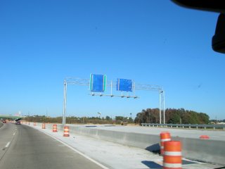
The ramp will officially open on Tuesday, November 15th, to traffic, but for now, all GA 20 traffic will be routed under the bridge and looped over.
The next phase of the ramp construction is to complete a new GA 20 eastbound ramp. Once this is done, the loop will be for westbound GA 20 traffic only. At this time, we do not know when it will be completed, but once we find out, we'll let y'all know.
That's all for now. Thanks for visiting and please do so again.
Friday, November 11, 2005
Veterans Day
Today, I just wanted to take some time to wish everyone a happy Veterans Day.
Regardless of your personal and political views, please take some time to reflect on how much veterans have contributed to defending our country and if you can, tell ones you know (both veterans and current military personnel) how much you appreciate their service on our behalf.
My little brother Chris, a U.S. Naval Academy alum, proudly serves us and I appreciate his doing so. I am a graduate of North Georgia College (and State University) and several alumni, staff, and even current students who are in the National Guard and reserves, are currently serving in Afghanistan and Iraq.
Here in Georgia, we have honored veterans with various stretches of highways, including, but not limited to, sections of various state highways being designated by the Georgia General Assembly as Blue Star Memorial Highways and naming the eastern stretch of I-20 from I-285 in DeKalb County to the South Carolina state line as the Purple Heart Highway.
Again, regardless of your personal and political views, please take some time to reflect and, if you can, personally thank a veteran and/or any current service member you may know. Freedom isn't free and thousands have sacrificed both life and limb so that we can continue to be free.
That's all for now. Thanks for visiting and please come back again.
Regardless of your personal and political views, please take some time to reflect on how much veterans have contributed to defending our country and if you can, tell ones you know (both veterans and current military personnel) how much you appreciate their service on our behalf.
My little brother Chris, a U.S. Naval Academy alum, proudly serves us and I appreciate his doing so. I am a graduate of North Georgia College (and State University) and several alumni, staff, and even current students who are in the National Guard and reserves, are currently serving in Afghanistan and Iraq.
Here in Georgia, we have honored veterans with various stretches of highways, including, but not limited to, sections of various state highways being designated by the Georgia General Assembly as Blue Star Memorial Highways and naming the eastern stretch of I-20 from I-285 in DeKalb County to the South Carolina state line as the Purple Heart Highway.
Again, regardless of your personal and political views, please take some time to reflect and, if you can, personally thank a veteran and/or any current service member you may know. Freedom isn't free and thousands have sacrificed both life and limb so that we can continue to be free.
That's all for now. Thanks for visiting and please come back again.
Wednesday, November 09, 2005
The New GA 400 Signs Are Here!!!
Fellow road enthusiasts, here is the official “Georgia Road Geek” debut of some of the brand new signage the Georgia DOT has recently placed along US 19/GA 400.
First, the new BGS gantry signs for Abernathy Road (Exits 5A-B) that replaced the old fiberglass ones:
First, the new BGS gantry signs for Abernathy Road (Exits 5A-B) that replaced the old fiberglass ones:

To see what the old ones looked like, please click here for the picture from the AARoads Georgia Gateway website.
Next, here’s a brand new BGS gantry for GA 140 (Exits 7A-B):
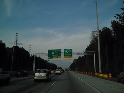
Here's one of the new large shield sets, this one located on the northbound side just past the Mansell Road exit (Exit 8):

Finally, as promised, here’s the infamous erroneous Roswell/Dahlonega distance sign as per my prior GA 400-related blogs:
Now that I’m thinking about it, perhaps GDOT is secretly trying to metricate us here in Georgia when they put “Roswell 9”, since 9 kilometers is approximately 5 miles. :)
To see what the old Roswell/Dahlonega distance sign looked like, please click here for the picture from AARoads Georgia Gateway website.
In other “Georgia Road Geek” news, here’s a picture I took while stuck in traffic on GA 9 (pre-1981 US 19) near the intersection of McFarland Road in Forsyth County:
This is indicative of the bottleneck that always occurs on this section of GA 9 during rush hour.
Forsyth County widened McFarland Road from 2 to 4-lanes divided with a grassy median from here to its other end at McGinnis Ferry Road (the Fulton/Forsyth County line). Both GA 9 and McGinnis Ferry are 2-lane roads which were never designed to carry near as much traffic as it does now. However, the Georgia DOT just recently redesigned the US 19/GA 400 interchange with McFarland (Exits 12A-B North, Exit 12 South). As soon as I can, I’ll get McFarland Road photos for y’all to see, but if you have any to share, then please e-mail it to steve#georgiaroadgeek.com and feature them in a future blog (with due credit to the photographer, of course).
That’s all for now. Thanks for visiting and please come back soon.
Monday, November 07, 2005
I-75/I-575 Toll Lane Project Proposal
According to today’s Atlanta-Journal Constitution (AJC), the Public-Private Initiative (PPI) to build special toll lanes on I-75 and I-575 in Cobb and Cherokee Counties, also known as the Northwest Corridor, is moving forward.
Please click here for the article from the AJC.
On Thursday, the Georgia DOT (GDOT) will hold a meeting to sketch out the latest proposal to create these special toll lanes on I-75.
Please click here for the official GDOT news release on the Northwest Corridor.
To learn more about other Georgia DOT PPIs, please visit the GDOT PPI Website.
That’s all for now. Thanks for visiting and please come back often.
Please click here for the article from the AJC.
On Thursday, the Georgia DOT (GDOT) will hold a meeting to sketch out the latest proposal to create these special toll lanes on I-75.
Please click here for the official GDOT news release on the Northwest Corridor.
To learn more about other Georgia DOT PPIs, please visit the GDOT PPI Website.
That’s all for now. Thanks for visiting and please come back often.
Sunday, November 06, 2005
A Georgian Helped Build The Interstates
Next year (2006) will be the 50th anniversary of the Eisenhower Interstate System, launched by the Federal-Aid Highway Act of 1956.
“A Georgia native, General Lucius D. Clay of Marietta, is credited with being the principal architect of the system. In 1954 President Eisenhower appointed Clay, who had managed the Berlin Airlift and presided over the rebuilding of Germany after World War II, to chair a committee charged with mapping out a national interstate highway system. Clay's leadership brought Interstates 75, 85, and 20 through Atlanta, cementing the city's destiny as a transportation hub.” [1]
The interstates as we know them were inspired by Germany’s autobahns, originally built during Adolf Hitler’s 12-year reign over Germany.
After World War II, Eisenhower was so impressed by these autobahns, he began to think about a similar system for the U.S. When he was elected President in 1952, he was able to take his dream and work toward making it a reality with the help of General Clay.
Today, because of their visions, we have the world’s largest network of national superhighways totaling “46,726 miles as of 2003” [1] (approximately 74,762 km). Germany, the birthplace of the modern superhighway, ranks a distant second with a total of “11,712 km in 2001” [2] (approximately 7292 miles).
To learn more about Georgia’s interstates and Germany’s autobahns, please click on the hyperlinks for each of the footnotes below:
1 - John D. Toon, Georgia Institute of Technology, “The New Georgia Encyclopedia – Transportation – Interstate Highway System”, 2004.
2 – Brian K. Purcell, “The Texas Highwayman: Driving In Germany – The Autobahn”, 2002.
That’s all for now. Thanks for visiting and please come back soon.
“A Georgia native, General Lucius D. Clay of Marietta, is credited with being the principal architect of the system. In 1954 President Eisenhower appointed Clay, who had managed the Berlin Airlift and presided over the rebuilding of Germany after World War II, to chair a committee charged with mapping out a national interstate highway system. Clay's leadership brought Interstates 75, 85, and 20 through Atlanta, cementing the city's destiny as a transportation hub.” [1]
The interstates as we know them were inspired by Germany’s autobahns, originally built during Adolf Hitler’s 12-year reign over Germany.
After World War II, Eisenhower was so impressed by these autobahns, he began to think about a similar system for the U.S. When he was elected President in 1952, he was able to take his dream and work toward making it a reality with the help of General Clay.
Today, because of their visions, we have the world’s largest network of national superhighways totaling “46,726 miles as of 2003” [1] (approximately 74,762 km). Germany, the birthplace of the modern superhighway, ranks a distant second with a total of “11,712 km in 2001” [2] (approximately 7292 miles).
To learn more about Georgia’s interstates and Germany’s autobahns, please click on the hyperlinks for each of the footnotes below:
1 - John D. Toon, Georgia Institute of Technology, “The New Georgia Encyclopedia – Transportation – Interstate Highway System”, 2004.
2 – Brian K. Purcell, “The Texas Highwayman: Driving In Germany – The Autobahn”, 2002.
That’s all for now. Thanks for visiting and please come back soon.
Friday, November 04, 2005
Speed, Cellphones, and GA 400
This morning, I came across a very interesting article regarding a plan to track traffic speeds andbottlenecks by "pinging" cellphones. Georgia DOT has contracted with a Marietta, Georgia, firm, AirSage, that will install special software in existing Sprint cell towers for this particular purpose.
For now, it will be done on a stretch of I-75 between the southside of I-285 near the Airport to Macon.
Please click here for the full article from the Atlanta-Journal Constitution.
As for other Georgia Road Geek news, there have been some more BGS replacements on US 19/GA 400 as follows:
- All "button copy" signs have now been dismantled (except the northbound BGS for Exit 5A/Abernathy Road/Dunwoody/Sandy Springs/Next Right).
- New reflective signs have been placed from Abernathy Road (Exit 5 South/Exits 5A-B North) to I-285.
- A new overhead gantry has been placed on the northbound side between the Chattahoochee River and GA 140 (Exits 7A-B, Holcomb Bridge Road).
- New pole-mounted reflective signs on the southbound lanes for GA 140/Holcomb Bridge Road/Roswell at the 1/2-mile point and the exit itself.
- New pole-mounted reflective signs at Mansell Road (Exit 8), one northbound at the 1/2-mile point, the other southbound at the exit itself.
BTW, GDOT has yet to correct their mileage sign error, where they replaced the "Roswell 5/Dahlonega 43" sign with "Roswell 9/Dahlonega 26". I hope to get a picture of this sign soon, but if you do, then please e-mail it to me (steve#georgiaroadgeek.com). I'll post it on the blogsite and give the photographer due credit.
Lastly, here's a special "shout-out" to fellow road enthusiast Pete Jenior for his upcoming completion of a Transportation Engineering degree from Georgia Tech. Pete's got a nice website with "roadgeek meet" pages and excellent historical info on Atlanta's transportation planning throught the last 60-70 years. Please click here to see Pete's Road Site.
That's all for today. Thanks again for visiting and please do so often.
For now, it will be done on a stretch of I-75 between the southside of I-285 near the Airport to Macon.
Please click here for the full article from the Atlanta-Journal Constitution.
As for other Georgia Road Geek news, there have been some more BGS replacements on US 19/GA 400 as follows:
- All "button copy" signs have now been dismantled (except the northbound BGS for Exit 5A/Abernathy Road/Dunwoody/Sandy Springs/Next Right).
- New reflective signs have been placed from Abernathy Road (Exit 5 South/Exits 5A-B North) to I-285.
- A new overhead gantry has been placed on the northbound side between the Chattahoochee River and GA 140 (Exits 7A-B, Holcomb Bridge Road).
- New pole-mounted reflective signs on the southbound lanes for GA 140/Holcomb Bridge Road/Roswell at the 1/2-mile point and the exit itself.
- New pole-mounted reflective signs at Mansell Road (Exit 8), one northbound at the 1/2-mile point, the other southbound at the exit itself.
BTW, GDOT has yet to correct their mileage sign error, where they replaced the "Roswell 5/Dahlonega 43" sign with "Roswell 9/Dahlonega 26". I hope to get a picture of this sign soon, but if you do, then please e-mail it to me (steve#georgiaroadgeek.com). I'll post it on the blogsite and give the photographer due credit.
Lastly, here's a special "shout-out" to fellow road enthusiast Pete Jenior for his upcoming completion of a Transportation Engineering degree from Georgia Tech. Pete's got a nice website with "roadgeek meet" pages and excellent historical info on Atlanta's transportation planning throught the last 60-70 years. Please click here to see Pete's Road Site.
That's all for today. Thanks again for visiting and please do so often.
Subscribe to:
Posts (Atom)


