Above photo from Terraserver-USA.
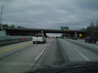
Many locals simply refer to the Athens Perimeter as "The 10 Loop".
The "half diamond" interchange in the bottom is Old Hull Road, which was originally US 29/GA 8 until the original northern section of the Athens Perimeter was completed in the 1960's.
Northward is US 29/GA 8, going toward Danielsville. (Elberton is also a "control city", but the BGS doesn't tell you Elberton is accessible via GA 72, which ends at US 29/GA 8 just north of this interchange.)
Westward is US 129/441/GA 15/10 Loop/422, "control cities" being Commerce (US 441) and Jefferson (US 129). IMHO, Gainesville should be a control city as well, since Gainesville is a major city within Northeast Georgia and US 129 links both Athens and Gainesville.
Southward is US 29/129/441/GA 15/10 Loop/422, Control cities being Watkinsville and Madison. IMHO again, Lexington, Macon, and Augusta, should be "control cities" as well (or at least acknowledged when motorists approach US 78/GA 10 East (Lexington) and US 129/441/ GA 15 South (Macon/Augusta).
For more info on the Athens Perimeter, please visit both AARoads "Georgia Gateway" and Peach State Roads, both sites containing excellent road pics and historical details.
That's all for now. Thanks for visiting and please do so often.

